|
|
|
|||||||||||||||||||||||||||||||||||||||||||||||||||||||||||||||||||||||||||||||||||||||||||||||||||||||||||||||||||||||||||||||||||||||||||||||||||||||||||||||||||||||||||||||||||||||||||||||||||||||||||||||||||||||||||||||||||||||||||||||||||||||||||||||||||||||||||||||||||||||||||||||
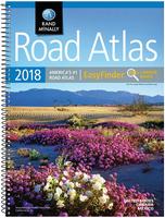
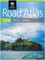 Rand McNally Mid-sized Easy-to-read Road Atlas. Rand McNally.
 Rand McNally Deluxe Motor Carrier's Road Atlas. Rand McNally.
 Rand McNally Motor Carrier's Road Atlas. Rand McNally.
 Sample #1
 Sample #2
 Sample #3
 | $24.95 | 62-53481 | Alaska recreation atlas. |
| $29.95 | 62-54481 | Arizona recreation atlas. |
| $29.95 | 62-56481 | California recreation atlas. |
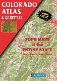
| $26.95 | 62-57481 | Colorado recreation atlas. |
| $26.95 | 62-64481 | Idaho recreation atlas. |
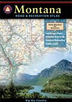
| $26.95 | 62-78481 | Montana recreation atlas. |
| $26.95 | 62-80482 | Nevada recreation atlas. |
| $26.95 | 62-83481 | New Mexico recreation atlas. |
| $29.95 | 62-89482 | Oregon recreation atlas. |
| $26.95 | 62-96482 | Utah recreation atlas. |
| $26.95 | 62-99482 | Washington recreation atlas. |
| $26.95 | 63-02482 | Wyoming recreation atlas. |
DeLorme Atlas & Gazetteer Series
All 50 states are available!
The Atlas & Gazetteer series is for people who want to leave the main roads behind. The atlases feature detailed topographic maps for the entire state in handy atlas form.
Each atlas features the most up-to-date road information for the state, from interstate highways to dirt logging roads. The maps also show an abundance of geographic features and landmarks, information on places to go and things to do, all cross-referenced to the map.
With each Atlas & Gazetteer you can:
- Explore back roads, dirt roads and trails
- Locate public lands for recreation
- Plan hiking, cycling and canoe trips
- Determine the best hunting and fishing spots
- Identify land use and land cover such as forests, agriculture, etc.
- Locate countless points of interest
 Sample from the Maine atlas
 Sample from the California atlas
| $29.95 | 62-5248 | Alabama. |
| $29.95 | 62-5348 | Alaska |
| $29.95 | 62-5448 | Arizona |
| $29.95 | 62-5548 | Arkansas |
| $29.95 | 62-5648 | California |
| $29.95 | 62-5748 | Colorado |
| $29.95 | 62-5848 | Connecticut & Rhode Island. |
| $24.95 | 62-6148 | Florida. |
| $29.95 | 62-6248 | Georgia. |
| $29.95 | 62-6348 | Hawaii. |
| $29.95 | 62-6448 | Idaho |
| $29.95 | 62-6548 | Illinois |
| $29.95 | 62-6648 | Indiana. |
| $29.95 | 62-6748 | Iowa. |
| $29.95 | 62-6848 | Kansas |
| $29.95 | 62-6948 | Kentucky |
| $29.95 | 62-7048 | Louisiana. |
| $29.95 | 62-7148 | Maine |
| $29.95 | 62-7248 | Maryland/Delaware |
| $29.95 | 62-7348 | Massachusetts. |
| $29.95 | 62-7448 | Michigan. |
| $29.95 | 62-7548 | Minnesota |
| $24.95 | 62-7648 | Mississippi. |
| $24.95 | 62-7748 | Missouri |
| $29.95 | 62-7848 | Montana |
| $24.95 | 62-7948 | Nebraska |
| $29.95 | 62-8048 | Nevada |
| $29.95 | 62-8148 | New Hampshire & Vermont |
| $29.95 | 62-8248 | New Jersey. |
| $29.95 | 62-8348 | New Mexico. |
| $29.95 | 62-8448 | New York State |
| $29.95 | 62-8548 | North Carolina |
| $29.95 | 62-8648 | North Dakota. |
| $29.95 | 62-8748 | Ohio. |
| $29.95 | 62-8848 | Oklahoma. |
| $29.95 | 62-8948 | Oregon |
| $29.95 | 62-9048 | Pennsylvania |
| $29.95 | 62-9248 | South Carolina. |
| $29.95 | 62-9348 | South Dakota |
| $29.95 | 62-9448 | Tennessee |
| $29.95 | 62-9548 | Texas |
| $29.95 | 62-9648 | Utah |
| $29.95 | 62-8148 | Vermont & New Hampshire |
| $29.95 | 62-9848 | Virginia |
| $29.95 | 62-9948 | Washington |
| $29.95 | 63-0048 | West Virginia |
| $29.95 | 63-0148 | Wisconsin |
| $24.95 | 63-0248 | Wyoming |
National Geographic State Recreation Atlas Series
Recreation Atlas series is for people who want a recreation atlas with brighter, easier-to-read road networks without the clutter of topographic contour lines. Every Benchmark atlas is specially designed for enthusiasts of hunting, fishing, camping, boating, hiking, and other outdoor activities. All atlases have Benchmark's exclusive Landscape Maps to show elevation without contour lines and have large easy-to-read type and page overlap, and a useful GPS grid. The categorized Recreation Guide makes planning your next adventure a breeze. The Recreation Maps have public land ownership shown as color tints, and most titles have hunting unit names and boundaries.
With each Atlas & Gazetteer you can explore back roads, dirt roads and trails, locate public lands for recreation, plan hiking, cycling and canoe trips, determine the best hunting and fishing spots, and locate countless points of interest.
 Sample #1
 Sample #2
 Sample #3
| $24.95 | 62-52485 | Alabama recreation atlas. |
| $24.95 | 62-62485 | Georgia recreation atlas. |
| $24.95 | 62-90485 | Pennsylvania recreation atlas. |