Below are the links to all of our fishing maps; nearly 1000 different maps. Any maps that we can supply are listed in the appropriate state listing. If you have a deadline, please tell us in the "Comments" section of the order form. We hope you enjoy the maps.
Please note - the maps listed in the files below are the only lake/river fishing maps that we can provide. If it is not listed here, we cannot provide it at this time.
Navionics. Over 75 maps covering popular lakes across the USA.
Fishwater Maps. 18 maps covering rivers in North Carolina and Tennessee.
Fishing Hot Spots Lake & Fishing Maps are superb maps showing the lake bottoms for hundreds of lakes and rivers across the USA. These maps are printed on either kimdura or Hop-syn (both tear-resistent waterproof synthetic materials), making them nearly indestructible. The maps show lake bottom contours, shoreline features, roads leading to the lakes, boating facilities along the lake shore, and much more.
Fishing Map sample Enlargement
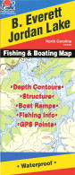
Fish-N-Map Company underwater topography maps are printed on a
waterproof, tear-resistant material and are folded to 9" x 4". When opened, each map is approximately 3' x 2' in size and is printed on both sides. These maps feature waterproof plastic "paper"; underwater
depth contours; fish locations; latitude and longitude for GPS; often multiple lakes on one map; boat ramps; recreational facilities; and much more. Click here to see sample images of the maps.
A.I.D. Fishing Maps. These maps show the topography of the lakebottoms and locations of shore facilities and lake buoys. There are nearly 60 maps for Texas lakes and another 15 maps for other lakes in the southern states.
Sample #1 Sample #2
Navionics Lake Fishing Maps. These maps show the topography of the lakebottoms and locations of shore facilities and lake buoys. Folded maps printed on synthetic "paper," making them nearly indestructible. The maps show color shaded depth contours
major routes and highways, are double-sided with detailed area insets, include area points-of-interest, and shows top-down satellite photo overlay of the lake and surrounding area.
 Fishing Hot Spots Lake & Fishing Maps are superb maps showing the lake bottoms for hundreds of lakes and rivers across the USA. These maps are printed on either kimdura or Hop-syn (both tear-resistent waterproof synthetic materials), making them nearly indestructible. The maps show lake bottom contours, shoreline features, roads leading to the lakes, boating facilities along the lake shore, and much more.
 Fishing Map sample
 Enlargement
 Fish-N-Map Company underwater topography maps are printed on a
waterproof, tear-resistant material and are folded to 9" x 4". When opened, each map is approximately 3' x 2' in size and is printed on both sides. These maps feature waterproof plastic "paper"; underwater
depth contours; fish locations; latitude and longitude for GPS; often multiple lakes on one map; boat ramps; recreational facilities; and much more.
Fish-N-Map Company underwater topography maps are printed on a
waterproof, tear-resistant material and are folded to 9" x 4". When opened, each map is approximately 3' x 2' in size and is printed on both sides. These maps feature waterproof plastic "paper"; underwater
depth contours; fish locations; latitude and longitude for GPS; often multiple lakes on one map; boat ramps; recreational facilities; and much more.  A.I.D. Fishing Maps. These maps show the topography of the lakebottoms and locations of shore facilities and lake buoys. There are nearly 60 maps for Texas lakes and another 15 maps for other lakes in the southern states.
 Sample #1
 Sample #2
 Navionics Lake Fishing Maps. These maps show the topography of the lakebottoms and locations of shore facilities and lake buoys. Folded maps printed on synthetic "paper," making them nearly indestructible. The maps show color shaded depth contours
major routes and highways, are double-sided with detailed area insets, include area points-of-interest, and shows top-down satellite photo overlay of the lake and surrounding area.
Navionics Lake Fishing Maps. These maps show the topography of the lakebottoms and locations of shore facilities and lake buoys. Folded maps printed on synthetic "paper," making them nearly indestructible. The maps show color shaded depth contours
major routes and highways, are double-sided with detailed area insets, include area points-of-interest, and shows top-down satellite photo overlay of the lake and surrounding area.

 Fishwater Fishing Maps. These maps cover the rivers in western North Carolina and eastern Tennessee. Popular with both fishermen and boaters, these waterproof maps cover areas for which no other fishing maps exist.
 Sample of the Nantahala River fishing map
 Sample of the Hiwassee River fishing map