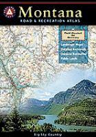
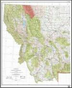
Montana Road and Recreation Atlas. 1:250,000. Benchmark Maps. Montana is the crown jewel of the American West. Experience the wild, Big Sky Country with our new Montana Road & Recreation Atlas. No other map product can better portray Montana's rugged peaks, majestic rivers, and expansive plains. Large-scale Landscape Maps and a 30-page Recreation Guide make it the ideal planning tool for any adventure.
Sample detail from the Montana recreation atlas.
$26.95
62-78481
Atlas
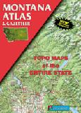
Montana Montana Atlas & Gazetteer. DeLorme. This is a superb topographic road atlas showing all roads including unimproved back roads. Includes tourist information and ideas of places to go and things to do.
$29.95
62-7848
Atlas
Montana Road Maps - Paper Maps
Montana Recreation Maps. 1:792,000. GTR Mapping.
Detailed travel maps - Interstates, exit numbers, highways, most local maintained roads. Topographic contours each 1,000 feet. Color shaded each 2,000 feet above 4,000 feet. Features include national forests, wilderness, campgrounds, parks, state wildlife areas, ski areas, mining districts, points of interest, and more. EAch map is 24 x 33".
Sample detail from the Montana recreation map.
$4.95
62-7891E
Eastern Montana recreation map. Folded.
$4.95
62-7891W
Western Montana recreation map. Folded.
New map Montana Recreation Map. Benchmark.
The Montana Recreation Map is the ideal planning tool for everything outdoors, from a rugged backcountry adventure to a nearby fishing spot. The map shows extensive highway detail and recreation overlay, over 100 campground listings, forest and wildlife areas, boating and fishing, and information resources.
Sample of the Montana recreation map by Benchmark
$7.95
62-78905
1 sheet, folded.
Montana Road Map - Paper. GM Johnson.
This is the most detailed single-sheet road map of Montana. It includes insset city maps of Billings, Butte, and Helena.
$5.95
62-78904
1 sheet, folded.
Montana/Wyoming Road Map - Paper. Rand McNally.
Rand McNally's Easy To Read State Folded Map is a must-have for anyone traveling in and around Montana and Wyoming, offering unbeatable accuracy and reliability at a great price. Our trusted cartography shows all Interstate, U.S., state, and county highways, along with clearly indicated parks, points of interest, airports, county boundaries, and streets. Includes inset maps of maps of Billings, MT; Butte, MT; Casper, WY; Cheyenne, WY; Great Falls, MT; Helena, MT; Missoula, MT; Waterton-Glacier International Peace Park, and Yellowstone/Grand Teton National Parks. Map size is 28 x 40 inches unfolded.
Sample of the Montana road map by Rand McNally
$7.99
62-7890
1 sheet, folded.
Montana Road Maps - Laminated Maps
Laminated Montana/Wyoming Road Map - Laminated. Rand McNally. The durable and convenient Montana and Wyoming EasyToFold state map will take all the wear and tear your journey can dish out. The heavy-duty laminated design allows you to mark your route, make notes, then wipe the surface clean for further use. Map size is 18 x 17 inches unfolded.
$7.95
62-78902
1 sheet, folded.
Laminated Montana Road Map - Laminated. GM Johnson. Laminated road map of Montana. Includes inset city maps of Billings, Butte, and Helena.
Billings & Bozeman City Map. Also covers Belgrade, Big Sky, Big Timber, Hardin, Livingston, Red Lodge, Roundup, and West Yellowstone. (GM Johnson).
$5.95
62-7892BU
Butte/Helena/Great Falls City Map. 1:32,000. (GM Johnson).
$5.95
62-7892MI
Missoula, Kalispell. With Whitefish, Glacier Park, NW Montana. 1:32,000. (GM Johnson).
Montana City Wall Maps
Montana City Wall Maps.
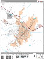
When it comes to general planning, defining delivery areas, planning direct marketing and delivering products, our city wall maps are perfect to get the detailed information you need.
These maps offer clear mapping by showing all major streets and roads and many of the smaller streets, but leaving out the smallest streets. If you want a clear map for easy planning, then these are the maps for you; if you want a map showing every little back alley, these are not for you.
We offer wall maps for Billings, Great Falls, Helena, and Missoula.
Click here to order and to see sample images, prices, sizes, and mounting options.
Montana Bicycling Maps. Montana is blessed with four long-distance trails that traverse the state from east to west and north to south. These include the Great Divide Trail, the Great Northern Parks Trail, the Lewis & Clark Trail, and the Northern Tier Transcontinental Trail.
Click here for our Montana cycling maps & guides list.
We stock all of the numerous USFS maps for Montana.
Montana Recreation Maps. 1:792,000. GTR Mapping. Detailed travel maps - Interstates, exit numbers, highways, most local maintained roads. Topographic contours each 1,000 feet. Color shaded each 2,000 feet above 4,000 feet. Features include national forests, wilderness, campgrounds, parks, state wildlife areas, ski areas, mining districts, points of interest, and more. EAch map is 24 x 33".
Sample detail from the Montana recreation map.
$4.95
62-7891E
Eastern Montana recreation map. 2007. Folded.
$4.95
62-7891W
Western Montana recreation map. 2010. Folded.
Waterproof! Glacier/Waterton National Park Hiking Map. 1:125,000. Trails Illustrated/National Geographic #215. Detailed topographic hiking map showing trails, campgrounds, viewpoints, and much more. Printed on waterproof, tear-resistant synthetic paper (tyvek or polyart)
Montana Hiking Map Index
$14.95
63-2100-215
1 sheet, folded.
Waterproof! Glacier National Park Sectional Hiking Maps. 1:50,000. National Geographic Maps/Trails Illustrated. There are three new detailed sectional hiking maps for Glacier National Park.
North Fork hiking map #313.
The North Side of the Map Includes: Kintla Lake, Bowman Lake, Quartz Lake, Logging Lake, Waterton Lake, Flathead River, Pacific Northwest Trail, and more..
The South Side of the Map Includes: Lake McDonald, Trout Lake, Avalanche Basin, Apgar Village, National Park Headquarters, Flathead River, Ousel Peak, and more...
Many Glacier hiking map #314.
The North Side of the Map Includes: Waterton Lakes National Park, Lower, Middle, and Upper Waterton Lakes, Blakiston Falls, Prince of Wales Hotel, Upper Kintla Lake, Continental Divide Trail, Goat Haunt, Pacific Northwest Trail, and more..
The South Side of the Map Includes: Cosley Lake, Glenns Lake, Ipasha Glacier, Chaney Glacier, Lake Josephine, Lake Sherburne, St Mary Lake, Many Glacier Hotel, Swiftcurrent Pass, Continental Divide Trail, Pacific Northwest Trail, and more...
Two Medicine hiking map #315.
Glacier & Waterton Lakes National Parks map pack. 1:70,000. Includes 63-2100-313 North Fork, 63-2100-314 Many Glacier, and 63-2100-315 Two Medicine maps.
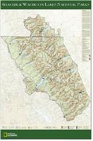
Glacier & Waterton Lakes National Parks Wall Map. National Geographic Maps. This beautiful wall map of Glacier and Waterton Lakes National Parks is in poster format for easy framing and hanging. Based on the popular Trails Illustrated map of these parks, this poster gives you rich topographic detail to show the park's magnificent lakes and terrain, as well as updated trail and road information. A perfect keepsake from this glorious area. Size is 24 x 36".
Thumbnail image of the entire map Sample of the map detail.
$16.99
62-7874G
1 sheet flat/rolled
$26.99
62-7874GL
Laminated.
Custer Battlefield Map. 1:5,280. USGS, 1981. A detailed topographic map of the Custer Battlefield area. Map size is 20 x 21".
$12.95
62-7875D
1 sheet, flat.
$19.99
62-7875DL
Laminated.
Glacier National Park Topographic Map. 1:100,000. USGS. A detailed shaded relief topographic map of the Glacier National Park area. The shaded relief adds a definite brown color to the map. Map size is 37 x 41".
$14.99
62-7875G
1 sheet, flat.
$29.99
62-7875GL
Laminated.
Waterproof Glacier National Park Topographic Map. 1:100,000. USGS. A detailed topographic map of the Glacier National Park and Waterton-Glacier International Peace Park area. This map is the more typical green colored topographic map. Map size is 37 x 41".
Thumbnail image of the entire map
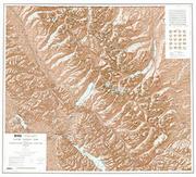
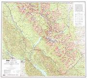
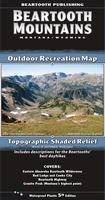
This map includes the entire Abasaroka-Beartooth Wilderness from Livingston to Red Lodge, the northern section of Yellowstone National Park, the famous Beartooth Highway, and Paradise Valley. It combines and updates all or parts of 85 USGS 7.5 minute quads, and shows trail mileages.
Sample detail from the Absaroka Beartooth Wilderness Map.
This map is the back side of the Absaroka - Beartooth map listed above, enlarged to twice the scale. The map covers from Red Lodge to the border of Yellowstone National Park. It has color coded trails which show the recreational users allowed on each trail, and symbols showing which fish species are found in each Montana lake.
Sample detail from the Beartooth Mountains Map.
$11.95
62-7871-BE
1 sheet, folded
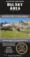
Waterproof Big Sky Outdoor Recreation Map, Montana. 1:50,000. Beartooth Publishing.
This map covers the Big Sky area from the Spanish Peaks to Yellowstone's Bighorn Pass Trailhead. The larger scale (two times the scale of the overview map listed below) is better for trail or backcountry use. It covers the Spanish Peaks and Monument Mountain Units of the Lee Metcalf Wilderness, most of the Taylor Hilgard Unit, and the northwest corner of Yellowstone.
Sample detail from the Beartooth Mountains Map.
$11.95
62-7871-BI
1 sheet, folded
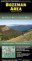
Waterproof Bozeman Area Outdoor Recreation Map, Montana. 1:50,000. Beartooth Publishing.
This map covers just the Bozeman area from Sacagawea Peak to Hyalite Peak. The larger scale is better for trail or backcountry use. It covers the Bridger and Bangtail Ranges and the popular Hyalite area in the Gallatin Range.
Sample detail from the Bozeman Area Map.
$11.95
62-7871-BO
1 sheet, folded
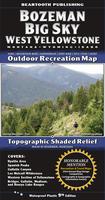
Waterproof Bozeman - Big Sky - West Yellowstone Outdoor Recreation Map, Montana. 1:100,000. Beartooth Publishing.
This map covers a large section of the largest intact ecosystem left in the 'lower 48'. The map includes the western section of Yellowstone National Park, the Lee Metcalf Wilderness, the Bridger, Gallatin, Madison, and Henrys Lake Mountain Ranges, the Hyalite area, the Spanish Peaks, and the Gallatin Canyon.
Sample detail from the Bozeman - Big Sky - West Yellowstone Map.
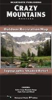
This island range in Southern Montana, north of the Absaroka and Beartooth Ranges, has about thirty peaks over 10,000 feet in elevation, most of them unnamed. The central, high elevation areas contain many alpine lakes, creeks, and small glaciers. The trails on the east side of the range, some of the most scenic trails in Southern Montana, are open to foot and horse travel only. On the west and north sides of the range there are many trails open to bicycles, and also several trails open to motorized travel.
Sample detail from the Crazy Mountains Map.
$11.95
62-7871-CR
1 sheet, folded
Waterproof Gravelly Range Hiking Map. 1:70,000. Beartooth Publishing.
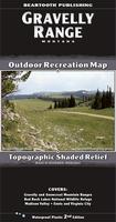
For a long time the Gravelly Range has been one of the best kept secrets in southern Montana. An auto or motorcycle tour of the Gravelly Range & Upper Ruby Roads is one of the best tours in the state: 90 miles of dirt road and amazing views. Most of the trail use in the Gravelly Range is from mountain bikers, motorcyclists, and ATVers. In the Snowcrest Range, hikers can enjoy several peak climbs in one of the most remote, hidden away areas in Montana.
This map covers the Gravelly Range, the Snowcrest Range, and the Madison Valley. From north to south it covers from Ennis to Red Rock Lakes National Wildlife Refuge.
Sample detail from the Gravelly Range hiking map.
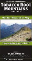
The Tobacco Root Mountains, located between Bozeman and Butte, is one of the most scenic ranges in Montana. Everyone who recreates here immediately puts this range on their list of favorite places. From rolling sagebrush hillsides to rugged alpine peaks and lakes, the scenery is as varied as it is great.
Sample detail from the Tobacco Root Mountains Map.
$11.95
62-7871-TO
1 sheet, folded
Hiking maps for western Montana. Cairn Cartographics.
Cairn Cartographics produces excellent hiking/topographic maps for western Montana, covering ares for which there are no other detailed hiking maps. These include beautiful, and popular, hiking areas as the Bob Marshall Wilderness, Selway-Bitterroot, Glacier National Park, and the Mission Range.
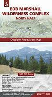
Bob Marshall North hiking map. 1:80,000. Covers North half of The Bob Marshall Wilderness Complex, Entire Great Bear Wilderness, Jewel Basin Hiking Area, Swan Crest (Alpine Trail), and Badger/Two Medicine area.
Sketch map showing map coverage. Sample detail of the map
$15.95
62-7872-BMS
Bob Marshall South hiking map. 1:80,000. Covers South half of The Bob Marshall Wilderness Complex, Entire Scapegoat Wilderness, Seeley Lake area (east of highway 200), Rocky Mountain Front (near Augusta), Chinese Wall, and the South Fork Flathead River - Youngs/Danaher confluence to Black Bear cabin.
Sketch map showing map coverage. Sample detail of the map
Mission Range hiking map. 1:60,000. Covers Mission Range from Bigfork to the Jocko Road, Entire Mission Mountain Wilderness and Tribal Wilderness, Pistol Creek Area, and Seeley Lake Area west of Highway 83.
Sketch map showing map coverage. Sample detail of the map
$13.95
62-7872-RW
Rattlesnake Wilderness hiking map. 1:40,000 / 1:19,000. Covers Entire Rattlesnake Wilderness, Rattlesnake National Recreation Area, Pattee Canyon National Recreation Area, Blue Mountain National Recreation Area, Gold Creek area, and Missoula Open Space.
Sketch map showing map coverage. Sample detail of the map
$15.95
62-7872-SBN
Selway-Bitterroot North hiking map. 1:80,000. Covers North Half of the Selway-Bitteroot Wilderness, Highway 12: Lolo to Lowell, Montana’s Bitterroot Valley: Lolo to Lost Horse, Selway River: Moose Creek to Lowell, and Bitterroot River: Wally Crawford Access to Lolo.
Sketch map showing map coverage. Sample detail of the map
$15.95
62-7872-SBS
Selway-Bitterroot South hiking map. 1:80,000. Covers South Half of the Selway-Bitteroot Wilderness, Magruder Corridor Road, Montana’s Bitterroot Valley: Lost Horse to East/West Fork Bitterroot Jct., Selway River: Paradise Put-in to Race Creek Takeout, West Fork Bitterroot Area, and Blue Joint Area
Sketch map showing map coverage. Sample detail of the map
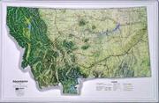
Montana Wall Maps
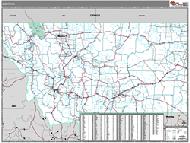
Montana State and County Wall Maps. Intelligent Direct.
We offer state and county wall maps for all of the USA. The maps come in sizes from 24 x 36 to 108 x 144 inches. They are available in variety of mounting and framing options. The maps are ideal for business applications, sales territory, delivery planning, direct mail targeting and hundreds of other applications.
Click here to order county wall maps and to see sample images, descriptions, and prices.
Click here to order state wall maps and to see sample images, descriptions, and prices.
When it comes to general planning, defining delivery areas, planning direct marketing and delivering products, our city wall maps are perfect to get the detailed information you need.
These maps offer clear mapping by showing all major streets and roads and many of the smaller streets, but leaving out the smallest streets. If you want a clear map for easy planning, then these are the maps for you; if you want a map showing every little back alley, these are not for you.
We offer wall maps for Billings, Great Falls, Helena, and Missoula.
Click here to order and to see sample images, prices, sizes, and mounting options.