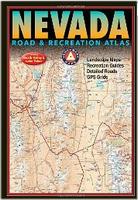
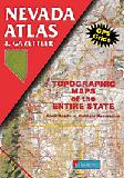
Nevada Road and Recreation Atlas. 1:280,000. Benchmark Maps. Nevada has long been known as the wildest adventure state in the lower 48, and this atlas is the first atlas to fully corral all of its marvels and outdoor potential. Careful and thorough field checking and local research assure users the best Nevada outdoor experience possible. Recreation maps show hunting units and public lands, emphasizing historic trails and points of interest.
Sample detail from the Nevada recreation atlas.
$26.95
62-80482
Atlas
Nevada Topographic Atlas & Gazetteer. DeLorme. Excellent atlas using USGS topographic maps. Ideal for hikers or backroad enthusiasts.
A sample from the Maine atlas.
$29.95
62-8048
Atlas
Nevada Road Maps
Nevada Recreation Maps. 1:792,000. GTR Mapping, 2009. Also includes all of Death Valley National Park. Detailed travel map - Interstates, most exit numbers, highways, many (not all) local roads. Topographic contours each 1,000 feet. Color shaded each 2,000 feet above 6,000 feet. Features include national forests, wilderness, campgrounds, parks, national conservation areas, wildlife refuges, state wildlife management areas, ski areas, mining districts, points of interest, and more.
Sample detail from the Nevada recreation map.
$4.95
62-80902
1 sheet, folded.
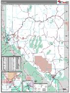
Nevada Road and Recreation Map. 1:950,400. Benchmark Maps. Benchmark's Nevada Road Map is the ideal portable planning tool and GPS companion for fast statewide travel. It's the only Nevada road map that benefits from Benchmark's extensive field-checking, proven accuracy and cartographic excellence. Beautiful shaded-relief road map of Nevada is on one side including mileage chart and placename index. The reverse side shows the urban regions of Las Vegas, Reno, and Carson City & Tahoe.
Sample detail from the Nevada recreation map.
$7.95
62-80903
1 sheet, folded
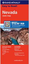
Nevada Road Map. Rand McNally. The map has clearly labeled Interstate, U.S., state, and county highways; a mileage chart and a Mileages & Driving Times Map;
indications of parks, points of interest, airports, county boundaries, and more; easy-to-use legend; and a detailed index. Detailed inset maps include: Carson City, Lake Mead National Recreation Area, Lake Tahoe Region, Las Vegas, Las Vegas Strip, Laughlin, and Reno. Map size, unfolded, is 25 x 37 inches.
$7.99
62-8090
1 sheet, folded.
Waterproof Nevada Road Maps
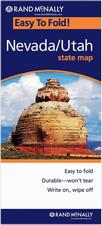
Nevada/Utah Easy-to-fold™ Road Map - laminated. Rand McNally. The durable and convenient Nevada and Utah EasyToFold state map will take all the wear and tear your journey can dish out. The heavy-duty laminated design allows you to mark your route, make notes, then wipe the surface clean for further use. This is a must-have for navigation whether you're a state resident or just passing through. Double-sided, size is 18 x 17 unfolded.
North Las Vegas & the Strip street map. (Rand McNally).
$8.95
62-8092LAS
Las Vegas street map. (ITMB).
$6.95
62-8092LP
Las Vegas Pop-out street map. (Popout). A pocket-sized "pop-out" folded map covering the main tourist areas of the city.
$6.95
62-80921LP
Las Vegas Popup street map. (Van Dam). A pocket-sized "pop-up" folded map covering the main tourist areas of the city. Similar do above but by a different company.
$5.95
62-8092RE
Reno & Sparks street map. 1:28,000. (GM Johnson).
Waterproof Nevada City Maps - waterproof. Various publishes. Folded waterproof street maps. "Laminated" indicates a paper map that has been laminated to make it water-resistant. "Waterproof" indicates a map printed on synthetic water-resistant and tear-resistant synthetic paper such as tyvek&tm; or polyart&tm;.
$8.99
62-8092LVG
Las Vegas Family Map. Waterproof. (Franko's). A map highlighting a family approach to Las Vegas, not just the casinos.
$8.99
62-8092LVS
Las Vegas Strip Map. Waterproof. (Franko's). A map highlighting the casinos and entertainment along "The Strip".
$9.95
62-8092LF
Las Vegas City Map. Laminated. (Borch).
$7.95
62-8092LM
Las Vegas City Map. Waterproof. (MapEasy).
$7.95
62-80921LAV
Las Vegas Destination map. Waterproof. (National Geographic Maps)
$7.95
62-8092LR
Las Vegas street map. (Red Map)
$6.95
62-8092LT
Las Vegas Streetwise map. (Streetwise). Laminated City Center Street Map of Las Vegas, Nevada - Folding pocket size travel map with monorail lines & stations - Las Vegas Strip Map.(Streetwise)
$7.95
62-80921LV
Las Vegas Streetsmart map. (Van Dam)
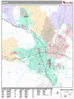
Nevada City Street Atlases. Various publishes.
$19.95
62-80922RE
Reno/Tahoe Street Atlas. Spiral-bound street atlas. (Rand McNally/Thomas Bros.).
Nevada City Wall Maps
Nevada City Wall Maps.
When it comes to general planning, defining delivery areas, planning direct marketing and delivering products, our city wall maps are perfect to get the detailed information you need.
These maps offer clear mapping by showing all major streets and roads and many of the smaller streets, but leaving out the smallest streets. If you want a clear map for easy planning, then these are the maps for you; if you want a map showing every little back alley, these are not for you.
We offer wall maps for Carson City, Greater Las Vegas, Henderson, Las Vegas, North Las Vegas, Paradise, Reno, Sparks, and Spring Valley.
Click here to order and to see sample images, prices, sizes, and mounting options.
Nevada State and County Wall Maps. Intelligent Direct.
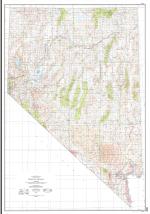
We offer state and county wall maps for all of the USA. The maps come in sizes from 24 x 36 to 108 x 144 inches. They are available in variety of mounting and framing options. The maps are ideal for business applications, sales territory, delivery planning, direct mail targeting and hundreds of other applications.
Click here to order county wall maps and to see sample images, descriptions, and prices.
Click here to order state wall maps and to see sample images, descriptions, and prices.
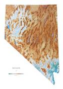
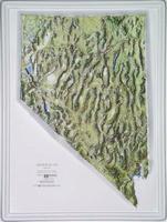
Nevada Shaded Relief Wall Map. 1:500,000. Raven Maps. Although Nevada is known for being the home of Las Vegas, it also has grassy valleys, rugged, snow-covered mountains, alkalai flats, and open sandy deserts. The beautiful glacial Lake Tahoe lies on the California border, and over 150 mountain ranges dominate the rest of the state. Elevations are represented by color, and this, in combination with our relief shading technique, gives the map a 3-dimensional look. Size is 106 x 155 cm (42 x 61").
Thumbnail of the map. Sample of the detail.
Nevada Magnetic Anomaly Map. 1:1,000,000. NBMG (M93A).
$12.95
62-8012
1 sheet, folded
Nevada Bouguer Gravity Quadrangle Map. 1:250,000. 1984. NBMG (Bulletin). These maps show gravity contours at 5-mGal intervals with terrain corrections. The data are plotted on a geologic base map. Sheet size is approximately 91 x 56 cm. Please specify area of interest.
$17.95
62-8013B
Death Valley (M-69).
$17.95
62-8013P
Ely
$17.95
62-8013D
Kingman (M-75).
Nevada Industrial Minerals Map. 1:1,000,000. 1973. NBMG (M-46). This map locates the industrial mineral deposits of the state. Map size is 80 x 82 cm.
$5.95
62-8045
1 sheet, folded
Nevada Geologic County Maps. 1:250,000. NBMG (Bulletin). Each map sheet illustrates the geology of the county, and comes complete with an extensive explanatory text. Being discontinued, limited stock left.