Asia, And Adjacent Areas Map 1942. National Geographic Society Maps. Battles were raging in Asia, Europe, and Africa at the time of this map's publication in December 1943. International boundaries on this map are as of September 1, 1939, the day Germany invaded Poland.
The 1942 Asia and Adjacent Areas map features:
Thousands of place names including capitals, cities, and towns
Airline distances
Principal railways, railways under construction, important routes, trails, and canals
Mountains, passes, rivers, lakes, deserts, glaciers, and areas below sea level
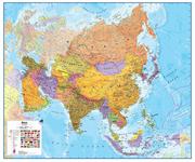
Asia Political Wall Maps. Maps International. A political wall map covering Asia and the western Pacific region, including Papua New Guinea, the Philippines, Malaysia, and part of the Federated States of Micronesia. Size is 39 x 47 inches.
Thumbnail of the Asia wall map
South East Asia Map Ports Wall Map. KG Johnson & Co. 41 x 28" ink jet plotted map of Asia, priced at $49.00, featuring Asia's Container Ports from Vladivostok in the north to Singapore in the south including inset maps featuring Japan's Inland Sea, Shanghai & Lower Yangtze River and Hong Kong and the Pearl River Delta.
Sample of the map detail Thumbnail image of the entire map
66-20936
Wall map
$99.99
Asia Travel Maps
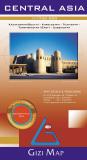
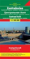
Recommended! Central Asia Geographical Map - Southern Kazakhstan, Kyrgyzstan, Tajikistan, Turkmenistan (East), Uzbekistan. 1:1,750,000. GiziMap, Budapest. This is an excellent shaded relief map of central Asia. The map has hypsometric shading, numerous spot elevations, railways, water wells and springs, and numerous tourist sites such as churches, monasteries, mosques, castles, and much more. Trilingual legend. Map size is 48" x 32" flat.
Area covered by this map. Sample of the map detail Thumbnail image of the entire map
66-2049
1 sheet, folded
$14.99
66-20491
1 sheet, flat.
$19.99
66-20491L
1 sheet, laminated.
$37.99
Central Asia Road Map - Southern Kazakhstan, Kyrgyzstan, Tajikistan, Turkmenistan (East), Uzbekistan. 1:1,750,000. GiziMap, Budapest, 2010. This is an excellent shaded relief map of central Asia. The map has railways, water wells and springs, and numerous tourist sites such as churches, monasteries, mosques, castles, and much more. Trilingual legend. Map size is 48" x 32" flat.
Sample of the map detail Sample of the map detail Thumbnail image of the entire map
66-20492
1 sheet, folded
$14.99
66-20493
1 sheet, flat
$19.99
66-20493L
1 sheet, laminated
$37.99
Waterproof! Central Asia Road Map. 1:1,700,000. Reise Know-How. This map combines topographic mapping with road and tourist detail. The road information is clear and elevation is shown using contours, spot heights and altitude shading. The map shows six different types of roads, highlighting scenic routes, places of interest, archaeological sites, monasteries, monuments and viewpoints.
Includes coverage of: Kyrgyzstan, Tajikistan, Turkmenistan, and Uzbekistan.
Central Asia Travel Map. 1:2,400,000. ITMB. This is a travel destination unlike any other and this double-sided map, covering from the Aral Sea to the Himalaya chain, is just the map to use to explore this fascinating part of our world. Printed on paper.
Sample #1 of the Central Asia map detail Sample #2 of the Central Asia map detail
66-20904
1 sheet, folded
$12.95
Central Asia Political Wall Map - Kazakhstan, Kyrgyzstan, Tajikistan, Turkmenistan, Uzbekistan, and northern Afghanistan and northern Pakistan. 1:1,750,000. National Geographic Society. This detailed print-on-demand wall map of Central Asian Republics by National Geographic features Kazakhstan, Uzbekistan, Kyrgyzstan, Turkmenistan, and Tajikistan, including portions of China, Iran, Afghanistan and Pakistan.
Sample of the Central Asia map detail Thumbnail image of the entire Central Asia map
66-20498
Paper, 29 x 36"
$24.95
66-20498L
Laminated, 29 x 36"
$34.95
66-20499
Paper, 36 x 48"
$44.99
66-20499L
Laminated, 36 x 48"
$54.99
Silk Road Countries Geographic (Physical) Map. GiziMap, Budapest. Superb map of the region, with wonderful color-shading to show elevation, camel symbols to show the various branches of the Silk Route, and much more. Available flat or folded. Covers from the Black Sea in the NW to Saudi Arabia (SW) to Western China (NE) to Western India (SE). The map has hypsometric elevation shading, shaded relief, numerous spot elevations, railways, water wells and springs, and numerous tourist sites such as churches, monasteries, mosques, castles, and much more. Trilingual legend.
Area covered by the map. Sample #1 of the map detail Sample #2 of the map detail Thumbnail of the entire map
66-20496
1 sheet, folded.
$14.99
66-20496R
1 sheet, flat.
$19.99
Silk Road Map. Odyssey Publications, 2007. This map contains four large maps, two per side; The Silk Road: Land and Sea Routes; The Silk Road Across China; The Silk Road Across the Middle East; and The Silk Road Across Central Asia. There is extensive text and photographs to accompany the maps. Double-sided map, size is 39 x 27".
Sample of the Silk Road Map detail.
66-20494
1 sheet, folded.
$19.99
Southeast Asia Travel Map. 1:4,000,000. ITMB. The part of the world from southern China, through the Indo-Chinese peninsula, and sweeping through the Indonesian archipelago to the hundreds of islands comprising the Philippines, is a fascinating part of the world to map. Countless cultures interact in this vast region - the mountain people along the Vietnamese/Laotian border, the fisherman of coastal regions and islands, the lovely and gentle Balinese, and the business-like Javanese. This is an extremely important part of the world - touristically attractive, economically thriving, and scenically unbeatable. This latest edition will be useful for anyone visiting the region. It is detailed, printed double-sided.
Sample detail #1 of the Southeast Asia Travel Map Sample detail #2 of the Southeast Asia Travel Map
66-20923
1 sheet, folded
$12.95
New edition Vietnam/Laos/Cambodia Travel Map. 1:1,250,000. ITMB. Covers the three countries in southeast Asia - Cambodia, Laos, Vietnam. ISBN 9781553410812.
66-20927
1 sheet, folded
$12.95
Asia Topographic Maps
Asia Topographic Maps. We offer topographic maps for most of the individual countries in Asia - please click on the links above to access those listings. An excellent overview topographic map series is the series listed below. Also available are 1:500,000 TPC aeronautical/topographic charts for much of Asia - click here to access these maps.
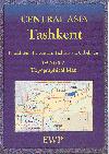
Recommended! Central Asia Topographic Map Series. 1:500,000. West Col/EWP, 2005. This 11-sheet map series was developed from the Soviet military 1:500,000 topos and transliterated into English, these very detailed maps include contour lines, railroads, airports, power lines, gas lines, and much more. A must for anyone travelling in the area. All sheets are now available.
Sample image Thumbnail of an entire map Index for the series
66-2065-01
Aksu.
$19.99
66-2065-02
Almaty.
$19.99
66-2065-03
Bishkek.
$19.99
66-2065-04
Chimkent.
$19.99
66-2065-05
Dushanbe.
$19.99
66-2065-06
Karakol.
$19.99
66-2065-07
Naryn.
$19.99
66-2065-08
Osh.
$19.99
66-2065-09
Pamir East.
$19.99
66-2065-10
Pamir West.
$19.99
66-2065-11
Tashkent.
$19.99
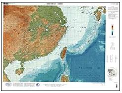
East Asia Geographic Map Series. 1:1,000,000. USGS. 1995-2000. This map series is both topographic and bathymetric. There are 8 sheets covering Japan, Coastal China, SE Asia, Indonesia, Papua New Guinea and Western Pacific Islands.
66-2051-1
Sheet 1. Japan, Korea, Northeast China.
$10.95
66-2051-2
Sheet 2. Southeast China.
$10.95
66-2051-3
Sheet 3. Southeast Asia.
$10.95
66-2051-4
Sheet 4. Philippines.
$10.95
66-2051-5
Sheet 5. Philippines & Western Indonesia.
$10.95
66-2051-6
Sheet 6. Eastern Indonesia.
$9.95
66-2051-7
Sheet 7. Papua New Guinea & the Solomon Islands.
$9.95
66-2051-8
Sheet 8. Western Pacific Islands.
$10.95
66-2050
Set of 8 sheets.
$72.95
Asia Historical Atlas
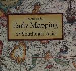
Early Mapping of Southeast Asia. Periplus. Southeast Asia has always occupied a special place in the imaginations of East and West. For the chinese, the islands of Southeast Asia lay in the 'southern ocean' while in India they were thought of as the 'lands below the wind'. In the West, Southeast Asia was identified with Paradise and the Garden of Eden.
It was also the supposed location of King Solomon's Ophir and Ptolomy's 'Golden Chersonese' - a place of stupendous riches and strange marvels, where spices grew and unicorns roamed the forest. This book recounts the fascinating story of how Southeast Asia was, quite literally, put on the map, both in cartographic terms and as a literary and imaginative concept. Hardcover.
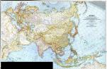
 Image of the entire map
 Sample of the map detail
 Thumbnail of the Asia wall map
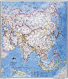
 An image of the full map
 A detail of the map
 A sample of the legend
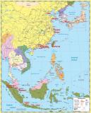
 Sample of the map detail
 Thumbnail image of the entire map
 Area covered by this map.
 Sample of the map detail
 Thumbnail image of the entire map
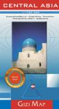 Central Asia Road Map - Southern Kazakhstan, Kyrgyzstan, Tajikistan, Turkmenistan (East), Uzbekistan. 1:1,750,000. GiziMap, Budapest, 2010. This is an excellent shaded relief map of central Asia. The map has railways, water wells and springs, and numerous tourist sites such as churches, monasteries, mosques, castles, and much more. Trilingual legend. Map size is 48" x 32" flat.
 Sample of the map detail
 Sample of the map detail
 Thumbnail image of the entire map
 Waterproof!


 Sample of the Central Asia map detail
 Sketch map showing area covered by the Central Asia Travel Map
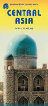
 Sample #1 of the Central Asia map detail
 Sample #2 of the Central Asia map detail
 Central Asia Political Wall Map - Kazakhstan, Kyrgyzstan, Tajikistan, Turkmenistan, Uzbekistan, and northern Afghanistan and northern Pakistan. 1:1,750,000. National Geographic Society. This detailed print-on-demand wall map of Central Asian Republics by National Geographic features Kazakhstan, Uzbekistan, Kyrgyzstan, Turkmenistan, and Tajikistan, including portions of China, Iran, Afghanistan and Pakistan.
 Sample of the Central Asia map detail
 Thumbnail image of the entire Central Asia map
 Area covered by the map.
 Sample #1 of the map detail
 Sample #2 of the map detail
 Thumbnail of the entire map
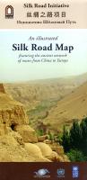
 Sample of the Silk Road Map detail.
 Sample detail #1 of the Southeast Asia Travel Map
 Sample detail #2 of the Southeast Asia Travel Map
 New edition

 Recommended!
 Sample image
 Thumbnail of an entire map
 Index for the series