Note: If you are looking for topographic maps of the Himalayas, including regions in China, Nepal, Pakistan, India, and Afghanistan, you should look in our Himalaya Maps Section. Due to the contested borders, etc., we use the Himalayas section as a central link to maps in the various country files.
At the moment some placement is arbitrary (the K2 topo map is in China because it was published in China as part of the series of Chinese mountain maps). We hope to address this in the next few weeks. If you have any questions, please contact us at [email protected]
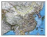
China Geographic Map. 1:4,750,000. Gizimaps.
This is a detailed road map of China with names in both Roman and Chinese script. The map has elevation shading for relief and state, disputed and administrative boundaries displayed. The maps show various categories of roads and railways, as well as world heritage, tourist and natural sites; also displayed are Olympic cities for the 2008 Beijing games.
There is a 3° latitude and longitude grid. Multilingual legend includes English and there is a detailed index on the reverse.
Sample of the map detail
$14.99
64-40496
1 sheet, folded.
$19.99
64-40497
Wall map, flat.
$36.99
64-40497L
1 sheet, laminated.
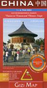
China Political Map. 1:6,500,000. Gizimap.
A single-sheet political map showing the province boundaries and the main cities within each province; the rivers; main sea routes between Chinese ports; and the location of the Great Wall of China. In English. ISBN 963-86808-6-5.
Sample #1 Sample #2
$14.99
64-40494
1 sheet, folded.
$19.99
64-40495
Wall map, flat.
$36.99
64-40495L
1 sheet, laminated.
Recommended! China regional map series. 1:2,000,000. Gizimap.
This series has detailed and attractive cartography, depicting the terrain through elevation tinting and including geographic details such as salt lakes, swamps, deserts etc.
Many landmarks, curiosities and protected areas are shown on the map, from the intriguing Three Unmortal Caves to the Huocheng Tortoise Protection Area. The map shows various categories of roads with distances, railways and administrative boundaries. A notable element is the Silk Road, the many branches of which traverse the region.
Typically the index is on reverse.
Index showing coverage of each map. Sample of the map detail.
$14.99
64-40961-1
Southern China (#1).
$14.99
64-40961-2
Central China (#2).
$14.99
64-40961-3
Northeastern China (#3).
$14.99
64-40961-4
Northwest China, Xinjiang Uygur Autonomous Region (#4).
$14.99
64-40961-5
Tibet (#5).
China regional maps - flat/rolled.
$19.99
64-40961-1R
Southern China (#1), flat/rolled.
$19.99
64-40961-2R
Central China (#2), flat/rolled.
$19.99
64-40961-3R
Northeastern China (#3), flat/rolled.
$19.99
64-40961-4R
Northwest China, Xinjiang Uygur Autonomous Region (#4), flat/rolled.
$19.99
64-40961-5R
Tibet (#5), flat/rolled.
China regional maps - laminated.
$36.99
64-40961-1L
Southern China (#1), flat/rolled.
$36.99
64-40961-2L
Central China (#2), flat/rolled.
$36.99
64-40961-3L
Northeastern China (#3), flat/rolled.
$36.99
64-40961-4L
Northwest China, Xinjiang Uygur Autonomous Region (#4), flat/rolled.
$36.99
64-40961-5L
Tibet (#5), flat/rolled.
China Travel/Road Maps
China Travel Atlas. 1:2,500,000. ITMB.
China is available in an enhanced scale in a book format that is compact in size, light-weight, and detailed enough for backpackers, businessmen, and those on a tour. China itself is portrayed on 76 pages of detailed maps. Two pages of Lhasa maps follow, then 11 pages devoted to Beijing, 7 to Shanghai, 8 to Hong Kong, and 8 more to Guangzhou (Canton). ISBN 9781553410751.
China atlas sample
$19.95
64-40967
Atlas
China Travel Map. 1:4,000,000. ITMB. Travel map with shaded relief, roads, etc.
$12.95
64-40952
1 sheet, folded.
Waterproof! China Adventure Road Map. 1:4,375,000. National Geographic Maps. This double-sided map combines topographic mapping with road and tourist information. The map has an index of place names, a 30' latitude/longitude grid, and names of major towns are given in both Latin script and Chinese characters. The map shows six different types of roads, highlighting scenic routes, places of interest, archaeological sites, monasteries, monuments and viewpoints. Size is 70 x 100 cm. In German with multilingual legend.
Sample detail from the China Adventure Map
China East Travel Map. The map includes hundreds of points of interest that highlight diverse and unique destinations in the region. UNESCO World Heritage sites, national parks and reserves, archaeological sites, temples, caves and points of interest such as the Great Wall of China and the Wall of Genghis Khan are included, making it an invaluable resource to travelers hoping to experience all the history and culture China has to offer. Additional travel aids include the location of airports, ports and ferry routes.
$11.95
64-40966W
China West Travel Map. The map includes hundreds of points of interest that highlight diverse and unique destinations in the region. UNESCO World Heritage sites, national parks and reserves, archaeological sites, temples, mosques, museums, ruins, caves and points of interest such as the Great Wall of China are included, making it an invaluable resource to travelers hoping to experience all the history and culture China has to offer.
(China) Illustrated Yangzi River Map. Airphoto International, in conjunction with China Exploration & Research Society. On one side is a map of the entire Yangzi River, with snippets of information noted along the route. A 7 x 9.5 inch inset map shows the Three Gorges area from Fengile to Yichang and notes the location/names of gorges and the twelve peaks of Wu Gorge. The reverse side of the map has a map showing the River from Chongqing to Yichange, including the Three Gorges. This map shows the locations of historic sites, gorges, and peaks plus snippets of information notated on the map. Inset maps are included for Shanghai, Wuhan, and Chongqing, along with several color photos, a satellite image, and descriptive text.
Sample of main Yangzi River map. Sample of Three River Gorges detailed inset map.
$15.95
64-40719
Airphoto.
(China) Scroll of the 5,000 Kilometer Long Yangtze River. 2002. An attractive accordian-folded strip map showing the 5,000 kilometers of the Yangtze River. The map, which is approx. 59 feet long when unfolded, shows the hydrology along the river, roads, villages and towns, cultural features, and more. There is descriptive text along the map plus several pages of introduction. Hardcover endplates. Size is 11-1/2 x 17". ISBN 7-5031-2633-7.
$275.00
64-40720
Atlas.
China Regional Maps. Nelles Verlag. These are excellent regional maps covering the eastern part of China. Please see the index map (click on blue button below) for specific coverage for each sheet. Multilingual.
$13.95
64-40953
Northeastern China. 1:1,500,000. (NV #1).
$13.95
64-40954
Northern China. 1:1,500,000. (NV #2).
$13.95
64-40955
Central China. 1:1,500,000. (NV #3).
$13.95
64-40956
Southern China. 1:1,500,000. (NV #4).
China Regional Maps. These are glossy tourist maps, typically of lower quality or less detail than the city maps above.
$3.95
64-40860
Changjiang Source Transportation Map. Includes city inset maps of major cities along the river. Chinese only.
$3.95
64-40861
Hai Luogou Glacier Map. A low quality tourist map. Chinese only.
$3.95
64-40862
Jiuzhai Gully Map. A small, generalized map. 1993.
China City Maps
Beijing City Maps.
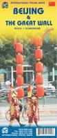
Waterproof! Beijing and the Great Wall Map. 1:20,000 (Bejing) & 1:100,000 (Great Wall). ITMB, 3rd ed., 2010. This updated edition includes new information post-2008 Olympics, such as the new subway line (No. 4) that has just been opened, plus new information about further extensions and lines being developed. The other side of the map is just as interesting. It covers the portion of the Great Wall of China that all visitors see, near Badaling, and also shows those sections that have disappeared over time, or have fallen into disrepair. As well, the famous Ming tombs of former emperors is also shown, as well as the Marco Polo bridge on the western edge of Beijing, so-named in honour of the famous trader/explorer who set out from this point on his return trip to Europe. ISBN 9781553416012.
Beijing map sample Great Wall map sample
$9.95
64-40920BH
1 sheet, folded
Laminated Beijing City Map. 1:30,000. Berndtson, 2011. Folded, laminated map of central Beijing at 1:30,000. Inset maps include the Beijing area at 1:150,000, Badaling at 1:25,000,
Chengde at 1:30,000, Forbidden City at 1:6,000, Fragrant Hills at 1:13,000, Ming Tombs at 1:125,000, Summer Palace at 1:6,000, Public Transport (Beijing Subway), and a time zone map. Touristic information includes: 15 top POIs (Points of Interest) shown in LocatorMap with text information, including e.g. opening hours and web links).
Sample detail of the Berndtson Cairo city map Image of the front of the Berndtson Cairo city map Image of the back of the Berndtson Cairo city map
$12.99
64-40920BEI
1 sheet, folded.
Laminated! (China) Beijing Laminated City Map. 1:24,000 & 1:75,000. Borch. Our soft-laminated folded map of Beijing in the 9th edition shows: Beijing 1:75 000, Central Beijing 1:24 000, Beijing and Region 1:1 200 000, Forbidden City 1:6000, Summer Palace 1:6000, Chengde 1:30 000, Fragrant Hills Park 1:13 000, Badaling 1:18 000, Public Transport Beijing, Top 30 sights, Beijing Shi administrative and China administrative and time zones. Borch maps are easy to fold, durable and water-repellent with a wipeable surface. Borch Maps show hotels, museums, monuments, markets, top sights and points of interest, useful statistics, conversion charts for temperatures, weights and measurements, climate charts showing temperatures, sunshine hours, precipitation and humidity, overview maps, time zones, and much more...
$9.95
64-405514
1 sheet, folded, laminated.
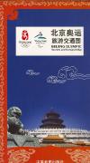
Recommended Official Beijing Olympic Venues - Tourism and Transport Maps. Sinomaps.
Four maps covering different aspects of Beijing and the Olympics. The maps use the same base street map, and overlay tourist information and additional data depending on their topic. The reverse sides of the maps are all different, focusing on the topic of that particular map. We recommend buying all four maps as they are quite distinct. The maps show the location of Olympic venues, tourist sites, public transportation throughout the city (with both Chinese and English station names), and much more. The reverse side of each map includes extensive information on the map topic, including photos, drawings, diagrams, and text. Bilingual English/Chinese.
Sample of the map detail
$9.99
64-40921BE
Environment Map. This map covers the "green" aspects of Beijing and the Olympics, from the rainwater collection system and water recycling plants to the energy-saving features built into the venues and other parts of Beijing.
$9.99
64-40921BH
Humanity. This map covers the cultural monuments and sites in Beijing, from the Summer Palace to the Forbidden City to the Panjiayuan Antique Market, plus numerous others.
$9.99
64-40921BT
Tourism and Transport Map. This map highlights all of the main tourist sites in and around Beijing from the Great Wall to the Forbidden City. Information on the reverse includes detailed site maps and transportation information.
$9.99
64-40921BV
Venues. This map highlights all of the venues of the Olympics and gives details of each building, public transport information for each site, and more.
Recommended China City Maps - in English. Trax2, China.
There is a real lack of English-language city maps for China thus the Trax2 maps are a welcome addition. These maps offer a city map on one side and a regional map on the reverse. There is a Mandarin phrase section along the margins offering a handy format for the most common tourist phrases. The city maps show locations of bus stations, with bus line numbers and subway lines and stations where applicable. Symbols locate tourist sites and facilities, such as pagodas, caves, tombs, temples, hotels, police stations, markets, and much more. The maps are bilingual throughout. These maps, at about 19 x 17 inches, are small enough that they are easily handled when out and about, but large enough to have useful levels of detail.
Sample of the map detail from the Guangzhou city map Image of the regional map from the Guangzhou map Image of the city map from the Guangzhou map
$5.95
64-40920BL
Beijing.
$8.50
64-40920DAL
Dali. 1 sheet folded.
$8.50
64-40920GR
Guangzhou.
$8.50
64-40920SHB
Shanghai.
$8.50
64-40920SHF
Shenzhen. 1 sheet folded.
$5.95
64-40920TIB
Tibet.
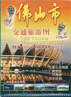
The Tour & Transportation Map of Foshan City. Planet Map. Detailed street map of Foshan City. With small inset map of subway system. In Chinese.
Sample detail of the Foshan City Map
$8.99
64-40920FO
1 sheet, folded.
The Tour & Transportation Map of Guangdong. China City Press. In Chinese with some English names for tourist sites, major cities, etc. The front has an administrative map of Guangdong province. The reverse has information, in Chinese only, on cities in the province. ISBN 9787806532126.
Front of the Guangdong Province Map Front of the Guangdong Province Map
$6.99
64-4052-04
1 sheet, folded.
The Tour Map of Guangzhou City. Planet Map. In chinese, with a little English. Detailed street map of Guangzhou City. The reverse side has a map of the distribution of tourist spots around Guangzhou, maps of the main shopping streets listing the stores along the streets (all store names are in Chinese only while street names are in English), plus an index, in Chinese.
ISBN 9787807210047.
Sample detail of the Guangzhou City Map
$8.99
64-40920GT
1 sheet, folded.
Shenzen City Map. Cartographic Publishing House of Guangdong Province. Bilingual English-Chinese. Detailed street map of Shenzen City urban area. This map has numerous English names for streets, hotels, tourist sites, etc. The reverse side has map of the western urban area of Shenzen. ISBN 9787807210047.
Sample detail of the Shenzen City Map Sample detail of the Shenzen City Map
$8.99
64-40920SJ
1 sheet, folded.
China City Street Maps. We offer two types of city street maps for China. One type are the new, glossy tourist city maps. These are typical tourist city street maps, printed on glossy paper, published between 1996 and 2001. Nearly all of these are bilingual maps, although a few are chinese only, as noted below.
These maps usually have a detailed city street map on one side and a regional map on the reverse, often with tourist information and photographs as well. Sheet size varies with the map. These are priced at $6.95. The second type are the older city tourist maps, typically in Chinese only and printed on non-glossy paper.
NOTE: The list below are the only city maps that we can get at this time. We have buyers in China typically twice per year and usually they bring back new maps, so please check back here every few months.
Hefei City Map. 2002. More detailed than the map below.
$7.95
64-40920HF
Hefei Tourist Map. 2002. Less detailed than the map above.
$7.95
64-40920HE
Hengyang. 2001.
$9.95
64-40920HO
Honghe Prefecture. In Chinese.
$7.95
64-40920HP
Huaihua. 2001.
$9.95
64-40920HT
Huzhou. Bilingual.
$9.95
64-40920JH
Jinggan. 2000.
$9.95
64-40920JI
Jinghong. 1995. Bilingual.
$9.95
64-40920JJ
Jiuzhaiguo Valley. 1999.
$9.95
64-40920KO
Korla. In Chinese. 1995.
$7.95
64-40920KU
Kunming. 1999. Chinese only.
$9.95
64-40920LB
Langshan region tour map. 1998.
$9.95
64-40920LC
Lanzhou. Bilingual. 1999.
$7.95
64-40920LD
Leiyang. 2001.
$9.95
64-40920LH
Lhasa Urban District Tour City Map. 2001. English.
$9.95
64-40920LI
LiJiang. In Chinese. 2001.
$7.95
64-40920LK
Liling. 2001.
$9.95
64-40920LJ
Lintong. In Chinese. 2000.
$7.95
64-40920LM
Liuyang. 2001.
$9.95
64-40920LO
Longquanyi. 1999.
$9.95
64-40920ME
Meishan District City Maps. 2000. Several city maps inset on a single sheet, each with postal codes. In Chinese.
$9.95
64-40920MI
Mianyang. 1998.
$7.95
64-40920NA
Nanchang. 1999.
$9.95
64-40920NB
Nanchong. 2000. In Chinese.
$9.95
64-40920NC
Nanjing. In Chinese.
$9.95
64-40920ND
Nan Xun.
$9.95
64-40920PD
Pengshan. 1997. In Chinese.
$9.95
64-40920PU
Pujiang, Zuyou, Jiaotongtu. 1999. In Chinese.
$9.95
64-40920QG
Qingdao. 2000. In Chinese.
$9.95
64-40920QI
Qionglai. 1998.
$9.95
64-40920RO
Ronchang County map. 1999. In Chinese, with city inset maps.
$7.95
64-40920SG
Shanghai. 1998. 1:30,000. Bilingual.
$8.95
64-405641
Shanghai. Periplus.
$9.95
64-40920SH
Shantou. 1998. Bilingual.
$7.95
64-40920SK
Shaoshan Tour. 1997.
$7.95
64-40920SM
Shaoyang. 2002.
$9.95
64-40920SI
Shenzhen. In Chinese. 1 sheet, folded
$9.95
64-40920SL
Shigatse. 1:10,000. 2000. Bilingual.
$9.95
64-40920SU
Suining. 2000. In Chinese.
$9.95
64-40920SV
Suzhou. 2000. In Chinese. Also shows postcodes.
$9.95
64-40920TO
Tong Li Historical Town. 2000. In Chinese.
$9.95
64-40920WB
Wanning. 2000.
$7.95
64-40920WC
Wanning Tour. 2000.
$9.95
64-40920WE
Wenjiang. 1997.
$3.95
64-40568
Wuhan.
$9.95
64-40920WT
Wuttan. 2001. In Chinese.
$9.95
64-40920WV
WuWei. In Chinese. 2000.
$9.95
64-40920WU
Wuxi. 2001. In Chinese.
$9.95
64-40920XI
Xi'an. 2000. In Chinese. Also shows postcodes.
$7.95
64-40920XF
Xiangtan. 2001.
$7.95
64-40920XG
Xiangxiang. 1998.
$9.95
64-40920XJ
Xinjin County map. (In Chengdu Prefecture in Sichuan Province). 1994. In Chinese.
$9.95
64-40920YA
Yanan City. In Chinese. 1999.
$9.95
64-40920YB
Yangshuo. 1999. Bilingual.
$9.95
64-40920YI
Yibin. 2000. In Chinese.
$7.95
64-40920YJ
Yichang City Tourist road map. 2000.
$7.95
64-40920YM
Yiyang. 1998.
$7.95
64-40920YO
Yongzhou Commercial and Tourist Map. 2001.
$7.95
64-40920YT
Yueyang. 2001.
$7.95
64-40920ZG
Zhuzhou. 2002.
$9.95
64-40920ZI
Zigong. 1999. Bilingual.
$9.95
64-40920ZJ
Ziyang. 1999. In Chinese.
$7.95
64-40920ZU
Zunyi Commercial and Tourist Map. 2001. Bilingual.
(China) Xian Yang (Xianyang)City Map. A detailed city street map, in Chinese.
$9.95
64-40920XM
Xianyang.
China Provincial Maps
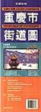
China City & Province Maps. Matu Publishing Ltd., Hong Kong. These maps have detailed city maps on one side and compact province administrative/road maps on the reverse. The maps and text are in Chinese with selected street names and village names. The following description for the Chongqing map applies to each map in the series.
Chongqing map description. The street plan of Chongqing City is quite detailed, indicating sub-district and area names, bus routes and terminals, railway lines and parks. Symbols marks all public and religious buildings including hospitals, police stations and post-offices, leisure and sport facilities (cinemas, swimming pools, stadium, etc.), and various accommodation facilities.
The road map of the Chongqing Province is at 1:12,000,000 and marks the various municipality divisions with administrative boundaries, three kinds of roads and tracks, railways and population density. Peak heights, hot springs, lakes and rivers are also indicated.
Various insets show overviews of some information about the Chongqing Province. There are also bus and train information and telephone numbers of various tourist boards, hotels and restaurants.
Information text is in Chinese only, many street, building, and town names are bilingual English/Chinese. Sample of both the city map and the province map
$14.99
64-40922FU
Fuzhou city & Fujian Province.
$14.99
64-40922GU
Guiyang city & Guizhou Province.
$14.99
64-40922HA
Hangzhou city & Zhejiang Province.
$14.99
64-40922LH
Lhasa (Lasha) city & Xizang Province.
$14.99
64-40922SH
Shijazuan (Shijiazhuang) city & Hebei Province.
$14.99
64-40922WE
Wenzhou city & Zhejiang Province.
$14.99
64-40922WU
Wuhan city & Hubei Province.
China Political/Geographic Maps of the Provinces. Star Publishing, Beijing. These detailed chinese-language maps illustrate drainage patterns, roads, railroads, lakes, reservoirs, airports, and more. The maps have a 1 x 1° lat-long grid for GPS use, but lack contour lines. We are discontinuing this series.
In Chinese.
$9.95
64-40521-06
Guangdong
$9.95
64-40521-07
Guangxi Zhuang
$9.95
64-40521-08
Guizhou.
$9.95
64-40521-12
Henan.
$9.95
64-40521-13
Hong Kong.
$9.95
64-40521-15
Hunan.
$9.95
64-40521-20
Liaoning.
$9.95
64-40521-31
Xinjiang Uygur.
$9.95
64-40521-32
Yunnan.
China City Maps. These are not true street maps for independent travelers wandering through a city. These maps, as shown by the two samples linked below, are maps that show the locations of various tourist sites in the city proper and the region surrounding the city.
Better than nothing, but I recommend the regular city street maps listed on our web site.
sample of downtown map of Chongqing sample of regional map of Chongqing
$6.95
64-40920DV
Dunhuang.
$6.95
64-40920SD
Shandong (hometown of Confucius).
$6.95
64-40920SW
Suzhou.
$6.95
64-40920TJ
Tianjin.
China Topographic Maps
China 1:200,000 Topographic Quadrangle Maps. 1:200,000. 1976-1991; most sheets are post-1983. Russian government. High quality topographic maps with good detail. Extensive descriptive text on the reverse of each sheet. Complete coverage of China in 1,634 sheets. In Russian. Individual sheets, raster scans, and georeferenced digital files are also available.
Sample #1 Sample #2 Sample #3
Recommended! Chinese Mountain Topographic Maps "The Maps of Snow Mountains in China". We now stock the superb topographic maps of major mountain peaks in China. These English-language maps, produced by a cartographer/geographer in Xi'an, offer superb topographic detail and descriptive text of major peaks such as Mt. Everest, K2, and several others. Contour interval is typically 40 meters.
We highly recommend these maps.
Mt. Everest map sample K2 map sample
$29.99
64-4085-04
Bogdu Uia Topographic Map. 1:50,000. 2001. A 5445 meter-tall mountain.
K2 (Mt. Qogori) Topographic Map. 1:100,000. No date.
$29.99
64-4085-14
Kangrin Boge Topographic Map. 1:100,000. 1997. A 6638 meter tall mountain.
$29.99
64-4085-16
Kawagarbo Topographic Map. 1:50,000. 2001. A 6740 meter-tall mountain.
$29.99
64-4085-18
Kongu Tagh-Muztag Ata Topographic Map. 1:100,000. No date.
$29.99
64-4085-20
Kunlun Goddess Topographic Map. 1:100,000. 2001. A 7167 meter-tall mountain.
$29.99
64-4085-22
Muz Tag Topographic Map. 1:100,000. 2001. A 6973 meter-tall mountain.
$29.99
64-4085-24
Naimona'nyi Topographic Map. 1:100,000. 1997.
$29.99
64-4085-26
Namjagbarwa Topographic Map. 1:100,000. 1997. A 7782 meter tall mountain.
$29.99
64-4085-30
Noijinkangsang Topographic Map. 1:50,000. A 7206 meter tall mountain.
$29.99
64-4085-38
Xixibangma Topographic Map.No date.
Batura Glacier Topographic Map. 1:60,000. 1978. This is an attractive map that covers the glacier and the north wall in great detail including contour lines. The rest of the map is shaded relief without contour lines. Bilingual.
$29.99
64-4085-02
1 sheet, rolled
Sketch Map of Landsat Image in the Karakoram Mountains. 1:500,000. Science Press, 1986. Two sheets; bilingual.
$19.95
64-40729
2 sheets, folded
Map of Peaks and Glaciers in the Qilian Mountains. 1:700,000. Two sheets.


 An image of the full map
 A detail of the map
 A sample of the legend
 An enlarged view of the mounted map
 Sample of the map detail
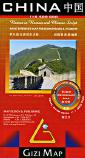
 Sample #1
 Sample #2
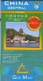 Recommended!
 Index showing coverage of each map.
 Sample of the map detail.
 China atlas sample

 Waterproof!
 Sample detail from the China Adventure Map
 Waterproof!
 Front of the West China travel map
 Reverse of the West China travel map
 Sample detail of the West China travel map
 Sample of main Yangzi River map.
 Sample of Three River Gorges detailed inset map.
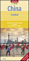


 Waterproof!
 Beijing map sample
 Great Wall map sample
 Laminated
 Sample detail of the Berndtson Cairo city map
 Image of the front of the Berndtson Cairo city map
 Image of the back of the Berndtson Cairo city map
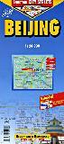 Laminated!
 Recommended
 Sample of the map detail
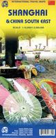
 Sample detail from the Shanghai city side of the map.
 Sample detail from the SE China side of the map.
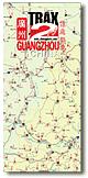 Recommended
 Sample of the map detail from the Guangzhou city map
 Image of the regional map from the Guangzhou map
 Image of the city map from the Guangzhou map


 Sample detail of the Foshan City Map
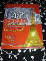
 Front of the Guangdong Province Map
 Front of the Guangdong Province Map
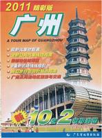
 Sample detail of the Guangzhou City Map
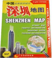
 Sample detail of the Shenzen City Map
 Sample detail of the Shenzen City Map
 Sample of Shanghai city map
 Sample of Chengdu city map
 Sample of Chongqing city map
 Sample of Nan Xun city map
 Sample of the Guiyang city map
 Sample of the Guangzhou map
 Sample of the Harbin map

 Sample of both the city map and the province map
 sample of downtown map of Chongqing
 sample of regional map of Chongqing
 Sample #1
 Sample #2
 Sample #3
 Index for northeast China.
 Index for northwestern China.
 Index for southeastern China.
 Index for southwestern China.
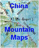 Recommended!
 Mt. Everest map sample
 K2 map sample