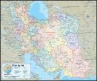
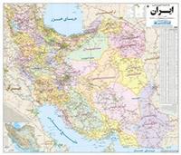
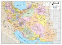
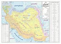
Superb wall map! Iran Geographic Map. 1:2,000,000. Gizimap.
A detailed shaded relief map of Iran. Elevation tinting and shaded relief shows heighth. Seven categories of roads range from autobahns to tracks. Numerous symbols locate tourist sites and services, UNESCO world heritage sites, religeous buildings, and much more. The legend is in five languages including English, while the map is in latin script with some Farsi city names.
Sample #1 of the map detail. Sample #2 of the map detail. Thumbnail image of the entire map.
64-78909
1 sheet, folded.
$14.99
64-78909R
1 sheet, rolled.
$19.99
64-78909L
1 sheet, laminated.
$36.99
Tehran & Iran Travel Map. 1:15,000 & 1:2,350,000. ITMB.
Popular Tehran street map showing names of neighborhoods and most streets. Main roads through/across the city are highlighted and access to the expressway is clearly shown.
Metro stations are marked and annotated with line numbers. A range of symbols shows various places of interest, tourist services and facilities: selected hotels (with names), embassies, places of worship, shopping centers, cultural institutions, bus terminals, etc. The index lists main streets, squares and neighborhoods. Also provided are a diagram of the metro lines and a road map of the city's environs with access to the international airport.
On the reverse is a very detailed map of Iran, quite suitable for anyone travelling around the country. It also shows the strategic importance of Iran very clearly! Having visited Iran, I can testify to the warmth and hospitality of the Iranian people and to the touristic pleasure one obtains visiting ruins, historic cities, religious centres, and desert-like terrain.
Sample of the Tehran map detail Thumbnail of the Tehran side of the map Thumbnail of the Iran side of the map
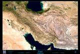
Sale! Iran 2004 road map. 1:3,000,000. Gita Shenasi & Allan Cartography-Oregon #269. In English. A good physical map of Iran with a satellite image as the base map. It has latitude and longitude at 2° intervals. Besides a legend in the margins it has photographs of tourist sites. 60 x 90 cm. Updated annually.
Detail of the map. View of entire map.
64-78911
One sheet, folded
$5.60
Waterproof! Iran Travel Map. 1:1,600,000. Reise Know-How. A double-sided map with eastern Iran on one side and western Iran on the reverse. The map shows elevations with contour lines, spot heights, and shaded relief. The map has a 1° lat-long grid making is useful for use with a GPS. Main railways, ferries, airports, oil pipelines, airfields and harbors are shown and symbols depict many features, such as frontier crossings, gas stations, hospitals, various historic sites and places of interest, campsites, oilfields, and oases. National parks and regional boundaries are also marked. Major town names are written in Persian and Roman script. Includes extensive index of place names. Printed on waterproof, tear-resistant synthetic paper. Bilingual English/German.
64-78901
1 sheet, folded
$15.99
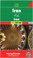
Recommended Iran Travel Map. 1:3,000,000. Freytag & Berndt.
Detailed road map of Iran by this leading European travel map publisher. Multilingual.
64-78917
One sheet, folded
$14.99
Tehran City Maps & Atlases
These are all city street maps but of varying detail, ranging from 1:10,000 multi-sheet maps to 1:75,000 regional maps. Some are bilingual English/Farsi, others are Farsi only. They are listed below in order of scale.
Tehran & Iran North Travel Map. 1:15,000 & 1:1,800,000. ITMB.
Popular Tehran street map showing names of neighborhoods and most streets. Main roads through/across the city are highlighted and access to the expressway is clearly shown.
Metro stations are marked and annotated with line numbers. A range of symbols shows various places of interest, tourist services and facilities: selected hotels (with names), embassies, places of worship, shopping centers, cultural institutions, bus terminals, etc. The index lists main streets, squares and neighborhoods. Also provided are a diagram of the metro lines and a road map of the city's environs with access to the international airport.
On the reverse is a map of northern Iran showing road and rail connections as well as local airports as well as an index. The main historical and archaeological sites are highlighted and some have brief descriptions. Topography is shown by elevation tinting with spot heights. The map also shows internal administrative boundaries with names of the provinces.
Coverage extends north to Baku, west to Baghdad and Kirkuk, south to Kuwait City and, within Iran, to Shiraz (including Persepolis) and Zahedan, and east to the borders with Turkmenistan and Afghanistan. The map has latitude and longitude lines at intervals of 2°
Sample of the Tehran map detail Sketch map showing the area covered by this map.
64-78931TI
1 sheet, folded
$12.95
Auto Atlas of Tehran & Suburbs. 1:40,000. Gita Shenasi #395, 2nd edition. Bilingual street atlas of Tehran. There is liberal use of symbols to show tourist sites and services, a bilingual symbol legend, an English index and a more comprehensive Farsi index. Contour lines and spot heights show elevation. Softcover, 5-1/2 x 8".
Sample of the map detail
64-78931TAA
Atlas.
$34.95
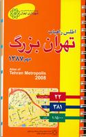
Atlas of Tehran Metropolis: Land and People, by the Urban Planning and Processing Co., Tehran GIS Centre. UPP, 2005. This thorough atlas of Tehran is a must for anyone interested in the administration and cultural geography of Tehran. The atlas is fully trilingual in English/French/Persian. The first 218 pages includes the Persian text and numerous trilingual (English/French/Persian) maps. The maps range from such subjects as number of households of 8+ people, to police districts, to dwellinlg units constructed with steel structure, to percent households in rental units. The 73 pages of English text follows the Persian section (the maps are not reprinted in this section).
64-78931TX
Atlas.
$99.99
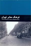
Tehran Encyclopedia (Farhang Maaber-e Tehran), by the Urban Planning and Processing Co., Tehran GIS Centre. UPP, 2007-2008. Softcover, in Persian. This is an encylopedia of Tehran streets and neighborhoods and does not contain maps. ISBN 978-964-7943-58-1.
64-78931TZ
Atlas.
$37.99
Tehran City Street Atlas by the Urban Planning and Processing Co., Tehran GIS Centre. 1:12,500. UPP, 2008. Spiral-bound detailed street atlas of Tehran. The first half of the atlas contains the maps while the second half includes the very detailed street index. In Persian, 305 pages.
Sample detail of the Tehran street atlas
64-78931TW
Atlas.
$29.99
Limited stock! Tehran City Map. 1:20,000. Gita Shenasi (#411), 2006. Very detailed 2-sheet map of Tehran. All streets are named. Size is 1m70cm x 2m (79 x 67"), in Farsi. ISBN 964-342-175-9.
64-78931TEH
2 sheets, folded.
$59.95
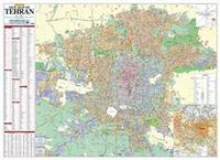
The most detailed map of Tehran! - limited stock! Tehran City Map. 1:10,000. Gita Shenasi (#385). Four sheets. In Farsi.
64-78931TG
4 sheets, folded.
$134.95
The New Map of Tehran & Suburbs. 1:20,000. Gita Shenasi (#180). 1994. This map shows all of the Tehran metropolitan area in relatively good detail. The detail of the downtown region is better on earlier maps, but all earlier maps lack the suburban coverage. This map includes separate annexed directory (only in Persian unfortunately) and four large color photographs of Tehran. All geographic features are labelled in Persian; legend is bilingual. Size is 100 x 140 cm.
Thumbnail view.
64-7893TE
1 set, folded
$34.95
Sale! Map of Tehran 1999. 1:20,000. Gita Shenasi #284. 2005. This is a detailed map but it covers less of the area surrounding Tehran. In Persian. Size is 100 x 140 cm. ISBN 964-342-063-9.
64-7893TJ
1 sheet, folded.
$22.99
Map of Greater Tehran 1999. 1:30,000. Gita Shenasi #286. 1999. This is a new persian-language map of Tehran and its suburbs. Size is 100 x 70 cm. ISBN 964-342-062-0.
64-7893TK
1 sheet, folded.
$14.95
New Map of Tehran. 1:30,000. Gita Shenasi #400. 2005. This is a new English-language map of Tehran and its suburbs. Size is 100 x 140 cm. With contour lines for area surrounding the city. Extensive index of embassies, museums, parks, and much more.
64-7893TO
1 sheet, folded.
$17.95
Guide Map of Tehran Underground. 1:85,000. Gita Shenasi #357, 2005. A bilingual map of Tehran's subway/underground system. Ideal for tourists/business travelers to the city.
64-78931TUN
1 sheet, folded.
$9.95
A Tourist Guide to Tehran. Gita Shenasi #293, 1999. This English-language map of Tehran is the best tourist map of Tehran. The map shows the major streets, but not the smaller streets and alleys. The map uses numbered symbols to locate tourist sites such as hotels, embassies, international agencies, museums, and lists them individually on the reverse.
The reverse of the map includes descriptions, a regional map, photographs, along with the aforementioned lists. This is the map we recommend if you are visiting as a tourist, or for public libraries or general reference collections. If you are visiting on business or have a more developed interest in Tehran, then we recommend one of the larger scale maps above, or the
administrative series of maps below.
64-7893TM
1 sheet, folded.
$13.95
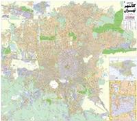
New Map of Tehran & Suburbs (topographic). 1:50,000. Gita Shenasi #246. Bilingual English/Farsi. This is a topographic city street map that includes the suburbs of Tehran. The map uses symbols extensively to locate numerous sites and tourist facilities such as mosques, police,
gas stations, fishing areas, animal husbandry farms, poultry farms, monuments, and much more. Includes 4 sheets of color photographs of various sites in Tehran.
64-78931TN
1 sheet, folded.
$28.95
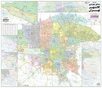
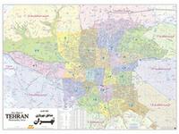
New Map of Tehran Municipality Areas (topographic). 1:50,000. Gita Shenasi #247. Bilingual English/Farsi. This topographic map emphasizes the administrative districts in Tehran and is a summary map of the detailed 1:10,000 series listed below.
The map has fewer streets than the 1:50,000 map listed above, but shows the administrative boundaries much more clearly.
Detail of the map. View of entire map.
64-78931TP
1 sheet, folded.
$28.95
Tehran City Street Maps by the Urban Planning and Processing Co., Tehran GIS Centre. UPP. We are offering these city street maps, produced by the Tehran city government map agency. Stock is limited and resupply is erratic.
64-78931TH
Map of Tehran. 1:16,000. 2005. Four sheets.
$49.99
64-78931TJ
Tourist Map of Tehran. 1:40,000. 2003. In Persian.
$12.95
64-78931TEF
Exploring the Faults of Tehran Map. 1:50,000. 2001.
$12.95
64-78931TK
Tehran Map. 1:40,000. 2005.
$12.95
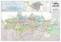
Map of Tehran Municipality Areas. Scale varies. Gita Shenasi. This series of maps offers complete, detailed coverage of Tehran and suburbs in 22 maps. The maps are detailed, with all streets named and numerous symbols showing tourist and government sites, parks, etc.
Not all maps are available yet; those currently available are listed below. In Persian, scale varies with the municipality area; sheets are approximately 100 x70 cm.
Small image of sheet #301 of the map set.
64-78931-301
Municipality Area #1 (map #301). 1:15,000.
$14.95
64-78931-302
Municipality Area #2 (map #302). 1:12,500.
$14.95
64-78931-303
Municipality Area #3 (map #303). 1:10,000.
$14.95
64-78931-304
Municipality Area #4 (map #304). 1:16,000.
$14.95
64-78931-305
Municipality Area #5 (map #305). 1:12,000.
$14.95
64-78931-306
Municipality Area #6 (map #306). 1:8,000.
$14.95
64-78931-307
Municipality Area #7 (map #307). 1:15,000.
$14.95
64-78931-308
Municipality Area #8 (map #308). 1:15,000.
$14.95
64-78931-309
Municipality Area #9 (map #309). 1:15,000.
$14.95
64-78931-310
Municipality Area #10 (map #310). 1:15,000.
$14.95
64-78931-311
Municipality Area #11 (map #311). 1:15,000.
$14.95
64-78931-312
Municipality Area #12 (map #312). 1:15,000.
$14.95
64-78931-313
Municipality Area #13 (map #313). 1:15,000.
$14.95
64-78931-314
Municipality Area #14 (map #314). 1:15,000.
$14.95
64-78931-315
Municipality Area #15 (map #315). 1:15,000.
$14.95
64-78931-316
Municipality Area #16 (map #316). 1:15,000.
$14.95
64-78931-317
Municipality Area #17 (map #317). 1:15,000.
$14.95
64-78931-318
Municipality Area #18 (map #318). 1:10,000.
$14.95
64-78931-319
Municipality Area #19 (map #319). 1:15,000.
$14.95
64-78931-320
Municipality Area #20 (map #320). 1:12,000.
$14.95
64-78931-321
Tehran Municipal Area #21, 2004.
$14.95
64-78931-322
Tehran Municipal Area #22, 2004.
$14.95
Iran Maps of Other Cities
Iran City Maps. Sahab and Gita Shenasi. Maps are in English (E), Farsi (F), or bilingual (B). Stock is limited on these maps.
Iran Tourist Map of Amol City. 1:10,000. Gita Shenasi #254. In Persian & English. The legend and the major roads are written in Persian & English. However, the smaller roads are either in Persian only or not labeled. In the margin there are pictures of the city's landmarks and text (in Persian) describing the city. 86 x 56cm.
64-7893AM
One sheet, folded
$12.95
(Iran)-Tourist Guide Map of Nahavand Township. 1:15,000 & 1:250,000. Gita Shenasi (#299). 1999. This map is a tourist item, with one side having numerous pictures and descriptive text. The other side has more tourist information, a small map of the city and a small regional map. In English.
64-7893NB
1 sheet, folded
$10.95
Iran City Street Maps by the National Cartographic Centre. NCC. We are offering for the first time these city street maps, produced by the Iranian government map agency. Many of these maps cover cities for which we have never offered maps, such as Borojerd, Eilam, etc. Stock is limited and resupply is erratic.
Sample detail of the Abadan city map
Tehran. A good summary map that includes map of Iran. Gita Shenasi (#341). (Bilingual). 100 x 70 cm.
$13.95
64-7893TBA
Tehran Bazar. Gita Shenasi (#147). (F). 100 x 70 cm.
$10.95
64-7893TC
Tehran, Greater. Gita Shenasi (#151). (F). 300 x 350 cm.
$110.00
64-7893U
Urmiyeh. 1:12,000. Sahab (#1021).
$13.95
64-7852-067
Yasuj city map and Kohgiluyeh-va-Boyerahmad Province. (Bilingual). Same as province map listed below.
$14.95
64-7893Y
Yazd. Sahab (#293). Old; 1980's? Sale price.
$8.99
64-7893Z
Zabol. 1:10,000. With Sistan Region map at 1:300,000. Gita Shenasi (#279). (Bilingual).
$6.99
64-7893ZH
Zahedan. 1:10,000. Sahab (#1009). (Bilingual). Note: sale price on older map.
$12.95
64-7893ZN
Zanjan. 1:10,000. Sahab (#1016). (F). Note: sale price on older map.
$12.95
Toyserkan City Map. Gita Shenasi, 2001. A tourist street map with an inset map of the province. Extensive descriptive text on the reverse. In Farsi
64-7892TO
1 sheet, folded.
$12.95
Keredz City Topographic Map. 1:10,000. Soviet government. This map is a regular topographic map that includes contour lines, power lines, rail/trolley lines, etc. In Russian.
Political Map of the Islamic Republic of Iran. Maps.com Loaded with place names, this Iran map is highly detailed with up-to-date accuracy. Beautifully illustrated with subtle hues, the detail is legible with international and provincial borders clearly defined. In classic Atlas style, portions of neighboring countries are also present. Perfect for any home or office, this map can be used for general reference, to track current events, or a piece of art. Flat/rolled.
Political Map of the Islamic Republic of Iran. 1:1,000,000. Gita Shenasi (#390), 2004. This is the largest scale political map of Iran that is currently available. With latitude/longitude grid. ISBN 964-342-161-9. In Farsi. Two oversized sheets.
Thumbnail image of the entire map
64-78510
2 sheets, folded.
$59.99
Map of Administrative Divisions of Islamic Republic of Iran. 1:2,250,000. Gita Shenasi (#296), 2005. This map shows the new boundaries of the 30 provinces. ISBN 964-342-075-2. In English.
64-78514
1 sheet, folded.
$15.95
General (Physical) Map of Iran. 1:1,600,000. Gita Shenasi (#491). A large (100 x 140 cm) map in English showing roads, shaded relief, airports, ports, monuments, etc.
64-78511
1 sheet, folded
$26.95
Iran Physical Map. 1:1,000,000. Gita Shenasi #340, 2003. Detailed physical map of Iran, in Farsi.
64-78512
1 sheet, folded.
$99.95
Islamic Republic of Iran Map [Political Map]. 1:1,600,000. Gita Shenasi (#449). A large (100 x 140 cm) map in English showing political boundaries, roads, etc.
64-78515
1 sheet, folded
$26.95
New Map of Islamic Republic of Iran. 1:1,600,000. Gita Shenasi #290. This is a large (100 x 140 cm) administration map of Iran showing the current 30 provinces. There are numerous information tables along the margin. In Persian.
Image of the entire map.
64-78513
1 sheet, folded.
$25.95
New Administration Map of Iran. 1:2,250,000. Gita Shenasi (#296), 2005. This English-language map shows the new political boundaries of the 30 provinces.
64-78514
1 sheet, folded.
$15.95
Iran Province Maps. Sahab and Gita Shenasi. These maps are generally shaded relief maps with roads, railroads, etc. overprinted. Farsi (F) or bilingual (Bilingual).
64-7852-015
Central Alborz. Gita Shenasi (#386). (F). 100 x70 cm.
$24.95
64-7852-01
Ardabil. Gita Shenasi (#241). (Bilingual). 60 x 90 cm.
$10.95
64-7852-02
East & West Azarbaijan & Ardabil. Gita Shenasi (#206). (Bilingual). 1994. 100 x 70 cm.
$14.95
64-7852-025
Azerbaijan East Province and Tabriz. 1;750,000 & 1:35,000. Gita Shenasi #292, 1999. This is a Farsi-only tourist map of Azerbaijan East province using a Raven satellite-image base map. A distance table is in the margin. The reverse has a general major-street map of Tabriz. Several color photos and some data tables are in the margin.
$14.95
64-7852-026
Azarbayjan-E-Sharqi-Gharbi Province & Orumiyeh City Map. 1:19,500 & 1:680,000. Gita Shenasi (#348), 2001. In Persian with a general legend in English. Size is 100 x 70 cm. Newer than 64-7852-02.
$13.95
64-7852-03
Bakhtaran. 1:1,000,000. Sahab (#1522). (F).
$9.95
64-7852-032
Central. Gita Shenasi. (F).
$9.95
64-7852-015
Central Alborz (Tehran Province). 1:300,000. Gita Shenasi #130. Combines with maps for Eastern Alborz (#386) and Western Alborz (#144) to give complete coverage of this region in Tehran Province. In Persian. Size is 100 x 70 cm.
$24.95
64-7852-016
Climbing the Peaks of Central Alborz. Gita Shenasi (#321). 1999. This is an artist's rendition of the area, using shaded relief and spot heights to show elevation. The map shows trails up the various mountains in the region. This is more of a souvenir map than a useful climbing map. Bilingual.
$12.95
64-7852-035
Esfahan. 1:300,000. Gita Shenasi (#469). (Bilingual). 100x 70 cm.
$21.95
64-7852-036
Esfahan. 1:670,000. Gita Shenasi (#243). (Bilingual). 100x 70 cm.
$29.00
64-7852-04
Fars. 1:1,000,000. 2003. Gita Shenasi (#364).
$13.95
64-7852-05
Gilan (Western Alborz). Gita Shenasi (#401). 2006. (Bilingual). 100 x 70 cm.
$12.95
64-7852-053
Golestan. Gita Shenasi (#499). (Bilingual).
$10.95
64-7852-055
Hamadan. Gita Shenasi (#163). (F). 100 x 70 cm.
$14.95
64-7852-056
Tourist Guide of Hamedan Province. 1:34,000 & 1:1,000,000. Gita Shenasi. 1999. This is a tourist guidebook with a small foldout map in the back. The book contains numerous photos showing various tourist attractions in the region. 83 pages, in English.
$12.95
64-7852-061
Hormozgan Province & Bandar Abbas city. 1:1,000,000 & 1:10,000. Gita Shenasi (#148) (Persian).
$29.95
64-7852-065
Ilam. Gita Shenasi (#207). (F). 100 x 70 cm.
$14.95
64-7852-066
Kerman. 1:1,000,000. 2005. Gita Shenasi (#393). (Bilingual). 100 x 70 cm.
$12.95
64-7852-067
Kohgiluyeh-va-Boyerahmad Province and Yasuj city map. Gita Shenasi (#342). 2001.
$14.95
64-7852-068
Khorasan. Gita Shenasi (#353). (Bilingual). 60 x 90 cm.
$12.95
64-7852-07
Khuzestan Province Tourist Map. Gita Shenasi (#445). (Bilingual). 100 x 70 cm.
$12.95
64-7852-071
Khuzestan Province Map. Gita Shenasi (#415). (Bilingual). 100 x 70 cm.
Iran Province Maps by Iranian National Geographical Organization of Armed Forces, Defense Ministry. It is interesting to compare the military province maps to the commercial and civil government maps. These province maps are all in Persian. Most have latitude/longitude tick marks in the margins and spot heights. Stock is limited and resupply is erratic.
Sample detail of the Eilam province map
64-7852-EIL
Eilam Province. 1:350,000. In Persian.
$12.95
64-7852-ISF
Isfahan Province. 1:750,000. In Persian.
$12.95
64-7852-KHO
Khozestan Province. 1:450,000. In Persian.
$12.95
64-7852-KOH
Kohkiloyeh va Boyer Province. 1:450,000. In Persian.
$12.95
64-7852-QUM
Qom (Qum) Province. 1:250,000. In Persian.
$12.95
64-7852-TE
Tehran Province. 1:400,000. In Persian.
$12.95
Iran Province Maps by the National Cartographic Centre. NCC. We are offering for the first time these province road maps, produced by the Iranian government map agency. Stock is limited and resupply is erratic.
Sample detail of the Bushehr province map
64-7852-ARD
Ardebil. 1:500,000. In Persian.
$12.95
64-7852-ISE
Isfahan. 1:650,000. In Persian.
$12.99
64-7852-QOM
Qum (Qom). 1:400,000. In Persian.
$12.95
64-7852-SOK
South Khorasan. 1:550,000. In Persian.
$12.99
Iran Province and City Street Maps by Iranshenasi. Iranshenasi. These maps typically have a province map on one side and a city map on the other side. Nearly all are in Persian, some with some English. Stock is limited and resupply is erratic.
Sample detail of the Tehran city map
64-7893BOS
Borojerd. 1:6,200 and 1:120,000. English/Persian.
$12.99
64-7852-CHA
Chahar Mahal o Bakhtiari & Shahr-e Kordistan Province. 1:6,000 and 1:370,000. Bilingual throughout.
$12.99
64-7852-EIK
Eilam Province and Eilam City. 1:5,800 and 1:500,000. In Persian.
$12.99
64-7852-HAN
Hamedan Province. 1:330,000. In Persian with some English.
$13.99
64-7852-ISG
Isfahan (Esfahan) Province. 1:670,000. In Persian with some English.
$13.99
64-7893KHP
Khoramabad. 1:6,516 and 1:330,000. In English/Persian.
$12.99
64-7852-KOJ
Kohkiloyeh va Boyer Ahmad Province. 1:330,000. In Persian with some English.
$13.99
64-7852-LOR
Lorestan Province. 1:440,000. In Persian.
$12.99
64-7852-MAR
Markazi Province. 1:350,000. In Persian with some English.
$13.99
64-7852-MAY
Mazandaran Province. 1:350,000. In Persian with some English.
$13.99
64-7852-NOK
North Khorasan Province. 1:350,000. In Persian with some English.
$13.99
64-7852-QAZ
Qazvin Province. 1:267,000. In Persian with some English.
$13.99
64-7852-SIS
Sistan va Balochestan Province. 1:850,000.
$13.99
64-78931TM
Tourist Map of Tehran City. 1:54,900. In Persian.
$13.99
64-7852-THE
Tourist Map of Tehran Province. 1:280,000. In Persian with some English.
$13.99
Iran Map of the Qeshm Free Area (Qeshm Island). 1:100,000. Gita Shenasi (#236). 1993. Detailed hypsometric map of this island lying in the Strait of Hormuz. Bilingual.
64-7880
1 sheet, folded
$12.95
Iran Railroad Map
Map of Islamic Republic of Iran Railways Network. 1:4,000,000. Gita Shenasi, 2005. Bilingual, ISBN 964-342-150-3.
64-78912N
1 sheet, folded.
$14.95
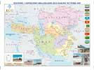
ECO (Economic Cooperation Organization) Railway Network Map. 1:4,500,000. Gita Shenasi #323, April 2006. The map shows railroads in existence, differentiating between systems of different widths and railways under construction, plus ferry transport in existence and under construction. The map also shows border crossing stations, railway stations, sea ports, and other localities. The map covers all of Iran and surrounding countries, from Romania to Saudia Arabia, from Kazakhstan to Pakistan. In English.
64-78912E
one sheet, folded
$17.95
Iran Atlases
Water Resources Atlas of Iran. 1:1,000,000. November, 1990. Ministry of Energy and Water Resources Management. This set of maps offers detailed information on the various aspects of water resources in Iran. This set consists of five 6-sheet maps bound into a single volume. The maps are accompanied by a two text volumes on Hydrology (volume 1) and Hydrogeology (volume 2); both are in Farsi only. The map sheets measure 100 x 70 cm. Bilingual.
64-7835-1
Map of the Water Quality. December 1985 data.
64-7835-2
Map of the Ground Water Exploitation. December 1985 data.
64-7835-3
Map of the Hydrogeology.
64-7835-4
Map of the Dams. 1982 data.
64-7835-5
Map of the River Flow Rates. 1982 data.
64-7835-6
Set of 5 complete maps
$800.00
Atlas of Iran & the World - Political, Physical & Economic. Gita Shenasi #129. This is a simple world atlas with some emphasis on Iran. In Farsi only. 56 pages. Size is 9" x 13".
64-78451
atlas.
$14.95
Pocket Atlas of Iran. 1:1,600,000. Gita Shenasi (#160). This pocket atlas is divided along administrative lines and includes geographic information and an index. The atlas measures 11 x 15 cm, contains 224 pages and is in Farsi.
64-7847
Pocket Atlas
$19.95
Road Atlas of Iran. 1:1,000,000. Gita Shenasi (#140). This Atlas (in Farsi) covers the roads and geography of Iran and is fully indexed. 96 pages. Size is 28 x 22 cm.
64-7848
Atlas
$54.95
Auto Atlas of Iran. Gita Shenasi (#213). This atlas has the road information highlighted. In Farsi. Size is 15 x 12 cm.
64-78481
Atlas
$14.95
City Atlas of Isfahan. Gita Shenasi. 1997. ISBN 964-6241-40-9. A detailed street atlas of Isfahan. There is a 13-page English-language introduction and street index, plus a separate, 40-page Farsi-language equivalent. The map is in Farsi with English names on the major streets and tourist notations. Perfect bound, 24 x 17 cm.
64-7893IS
Atlas
$26.95
Iran and Tehran Satellite Image Posters. WorldSat.
64-78919
Iran. 36 x 24".
$37.95
64-7893TA
Tehran. 36 x 24".
$37.95
Iran Geologic and Thematic Maps
Iran Geologic Map. 1:2,500,000. 1989, 2nd edition. Geological Survey of Iran. Excellent detail, with stratigraphic columns. Bilingual.
64-7800
1 sheet, rolled
$49.95
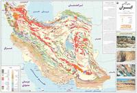
Geologic Map of Iran. 1:2,500,000. Gita Shenasi (#379), 2003. Generalized geologic map of Iran, in Farsi. With 2° lat-long grid.
Thumbnail image of the entire map.
64-7801
1 sheet, folded.
$14.95
Iran Metamorphic Map. 1:2,500,000. 1986. GS. Shows generalized metamorphic belts, with information on facies series, rock type, metamorphic episodes, etc. This bilingual map measures 100 x 77 cm.
64-7805
1 sheet, rolled
$39.95
Iran, Afghanistan, Pakistan--Seismotectonic Map. 1:5,000,000. UNESCO. 1984. This is the most recent map that is available for the region. With 25-page text.
64-7820
1 sheet, rolled + text
$25.00
Iran Epicenters & Focal Depths. 1:2,500,000. 1973. GS. This map shows the epicenters for earthquakes occurring during the period 1900-1973. In black and white.
64-7822
1 sheet, rolled
$19.95
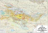
Map of Tehran Province Faults. 1:280,000. Gita Shenasi (#416), 2006. A shaded relief map with the geologic faults overprinted. The faults are categorized and named. Bilingual. ISBN 964-342-186-4.
Thumbnail image of the Tehran Faults Map.
64-78931TF
1 sheet, folded.
$13.95
Iran Geomorphic Map. 1:2,500,000. TAVO. 1990. Two sheets; bilingual.
64-7830
2 sheets, rolled
$48.95
Iran Agriculture, Livestock, and Fishery Pictorial Map. 1:3,000,000. Sahab (#0503). Size is 60 x 90 cm.
Iran Carpet. 1:3,000,000. 1997. Gita Shenasi & Allan Cartography-Oregon #269. In English. A good physical map of Iran. It has latitude and longitude at 2° intervals. Besides a legend it has lists of carpet weaving centers and of administrative divisions. 65 x 96 cm.
64-7882
One sheet, folded
$12.95
Iran Ethnological Pictorial Map. 1:3,000,000. Sahab (#0502). Size is 60 x 90 cm.
64-78312
1 sheet, folded
$12.95
Iran Wildlife Pictorial Map. 1:3,000,000. Sahab (#0505). Size is 60 x 90 cm.
64-78313
1 sheet, folded
$12.95
Iran Climate Map. 1:2,500,000. Gita Shenasi (#229). Size is 100 x 70 cm. In Persian.
64-7839
1 sheet, folded
$12.95
Mineral Distribution Map of Iran. 1:1,000,000. Iran Geological Survey, 1993. Four sheets. The map shows locations and type of mineral deposits noted on a generalized geologic base map. Several inset maps show copper deposits, non-metallic deposits, and more. In English.
64-78401
4 sheets, folded
$149.99
Iran Contributions to the Geology of Mineral Resources. GS. A book containing several small maps.
64-7841
Each
$34.95
Iran Physical & River Basins Map. 1:2,000,000. Gita Shenasi #278. 1998. This is an attractive map of Iran as it utilizes a Raven Images satellite image map of Iran as a base map. River drainages are marked and some data is in the margin.
For those that cannot read Persian, this is an attractive large-scale physical map of Iran. In Persian. Size is 140 x 100 cm.
64-7838
1 sheet, folded.
$29.95
Water Resources Map of Iran. 1:2,500,000. Gita Shenasi #280. This Farsi-only map shows the hydrography of Iran. The map shows three levels of rivers, dams, lakes, intermittant lakes and the locations of wells.
64-78381
1 sheet, folded.
$14.95
Iran Geologic Quadrangle Map. 1:250,000. GS. These maps offer coverage of most of Iran. Those priced at $17.95 do not contain a text; all others have a text of 25-250 pages. In English.
NOTE: These are nearly all out of print and very difficult to get. We can provide some as raster scans.