|
|
Maps by Zagier & Urruty
Maps by SIG Patagon
Maps by Pixmap (formerly Aoneker)With the untimely death of company founder Diego Vallmitjana, Aoneker has merged into Pixmaps run by a former associate of Diego. The maps remain of very high quality and the breadth of coverage is significant.
Chile Hiking Maps by Trekking Chile
 Sketch map showing sheet coverage Sketch map showing sheet coverage
 Sample detail from the Laguna del Maule map. Sample detail from the Laguna del Maule map.
 Sample detail from the Nevados de Chillán map. Sample detail from the Nevados de Chillán map.
 Sample detail from the Putre map. Sample detail from the Putre map.
 Sample detail from the San Pedro de Atacama map. Sample detail from the San Pedro de Atacama map.
Patagonia and Chile Maps by JLM Mapas
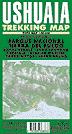
Ushuaia & Tolhuin MapsTolhuin City Map, Argentina. Pablo Bordignon, 2000. A small (15 x 19") tourist map of the city, including tourist information such as hotels, hospitals, etc. In Spanish.
Ciudad de Ushuaia City Plan. No scale. Pablo Bordignon. This is a tourist street map of the main part of Ushuaia, the southernmost city in South America. The map includes symbols showing the location of tourist services such as movie theaters, restaurants, government buildings and much more. A street index is also included. The reverse side has a listing of hotels, a brief history of the town, and more. Bilingual.
Aconcagua MapsSee also Pixmap Hiking Maps above. Aconcagua Topographic Maps. 1:100,000. IGN. These are four 1:100,000 topographic maps of Cerro Aconcagua produced by the Argentina IGN. These maps are color-copies of map sheets that are now out of print.
While these maps are expensive, they are very detailed and the best maps by far for the mountain. In Spanish. Note that the summit is within a half-inch of the corner of one of the sheets as shown on the sample; you really do need all four sheets to show the mountain.
Aconcagua Topographic Maps. 1:50,000. IGN. These are four 1:50,000 topographic maps of Cerro Aconcagua produced by the Argentina IGN. These maps are color-copies of map sheets that are now out of print.
While these maps are expensive, they are very detailed and the best maps by far for the mountain. In Spanish. Note that the summit is within a half-inch of the corner of one of the sheets as shown on the sample; you really do need all four sheets to show the mountain.
|
||||||||||||||||||||||||||||||||||||||||||||||||||||||||||||||||||||||||||||||||||||||||||||||||||||||||||||||||||||||||||||||||||||||||||||||||||||||||||||||||||||||||||||||||||||||||||||||||||||||||||||||||||||||||||||||||||||||||||||||||||||||||||||||||||||||||||||||||||||||||||||||||||||||||||||||||||||||||||||||||||||||||||||||||||||||||||||||||||||||||||||||||||||||||||||||||||||||||||||||||||||||||||||||||||||||||||||||||||||||||||||||||||||||||||||||||||||||||||||||||||||||||||||||||||||||||||||||||||||||||||||||||||||||||||||||||||||||||||||||||||||||||||||||||||||||||||||||||||||||||||||||||||||||||||||||||


 Sample detail of the Patagonia travel map
 Front of the Patagonia travel map
 Reverse of the Patagonia travel map
 Thumbnail of the map
 Detail of the map
 Detail of the map
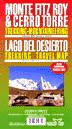
 Thumbnail of the map.
 Detail of the map.
 Legend of the map.
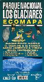 Glacier National Park (Los Glaciares). 1:250,000. Zagier & Urruty. A good shaded relief map covering this popular national park. The map shows roads, distances between junctions, gas stations, etc. In Spanish.
 Thumbnail image of the map.
 Detail of the map.
 Legend of the map.
 Cover of the map.
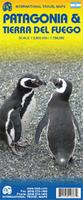
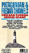
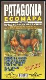 Patagonia Travel Map (Rutas de Argentina & Chile). 1:2,300,000. Zagier & Urruty. A good hypsometric/shaded relief map covering the southern portion of South America. The map shows roads, distances between junctions, gas stations, etc. In Spanish.
 Thumbnail image of the map.
 Detail of the map.
 Legend of the map.
 Cover of the map.
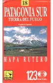
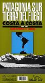 Patagonia Sur & Tierra del Fuego, Costa a Costa. 1:1,000,000. Zagier & Urruty. A good hypsometric/shaded relief map covering the southern portion of South America. The map shows roads, distances between junctions, gas stations, etc. In Spanish.
 Thumbnail image of the map.
 Detail of the map.
 Legend of the map.
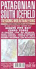 Patagonian South Icefield & Monte Fitz Roy Map. 1:50,000. Zagier & Urruty. The best ever trekking map of this popular area. 50 meter contour lines, timed trails, shelters, camping and inns. Realistic relief based in satelital imagery. Los Glaciares National Park, Monte Fitz Roy, Cerro Torre, Cerro Huemul, Lago del Desierto, Lago O'Higgins, Lago Viedma, Icefield, etc. 102 x 72 cm. ISBN 1-879568-09-8.


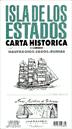
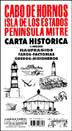 Cape Horn Historical Map (Cabo de Hornos, Isla de los Estados, Peninsula Mitre). 1:400,000. Zagier & Urruty. Historical and hydrographical chart. Shipwrecks, lighthouses, gold diggers, missionaries, sealers, etc. Size is 102 x 72 cm. ISBN 1-879568-69-1.
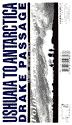 Drake Passage - Ushuaia to Antarctica. 1:5,000,000. Zagier & Urruty. The ship voyage from South America to the Antarctic Peninsula is a travel of a lifetime. After two days navigating on a sea miles deep with the strongest and wildest currents and winds, the traveler arrives to a paradise for people looking for nature, history and adventure.
This map is based in the Argentine Hydrographic Survey and the Ushuaia Maritime Museum charts and includes historic sites in the area as well as place for stamps and signatures from the ship and stations crew. A certificate for having crossed the Drake Passage is printed, too.
Drake Passage - Ushuaia to Antarctica. 1:5,000,000. Zagier & Urruty. The ship voyage from South America to the Antarctic Peninsula is a travel of a lifetime. After two days navigating on a sea miles deep with the strongest and wildest currents and winds, the traveler arrives to a paradise for people looking for nature, history and adventure.
This map is based in the Argentine Hydrographic Survey and the Ushuaia Maritime Museum charts and includes historic sites in the area as well as place for stamps and signatures from the ship and stations crew. A certificate for having crossed the Drake Passage is printed, too.


 Tierra del Fuego. 1:500,000. Zagier & Urruty. Shaded relief map covering the whole island of Tierra del Fuego. Also shows campgrounds, fishing sites, telephones, etc. In Spanish.
 Thumbnail of the map.
 Detail of the map.
 Legend of the map.
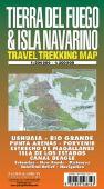 Tierra del Fuego & Isla Navarino hiking map. Zagier & Urruty. The map covers the Argentine and Chilean sectors of Tierra del Fuego. It shows satellite relief, ski resorts, secondary roads, insets of Staten Island and Isla Navarino. ISBN 1-879568-14-4.

 Thumbnail of the entire map.
 Detail from the map.
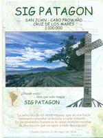
 Sample detail of the Tierra del Fuego Map
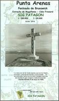
 Front of the Punta Arenas Map
 Reverse of the Punta Areans Map
 Sketch map showing area covered by the Punta Arenas map
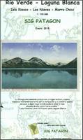 New map, waterproof
 Sample detail from the Rio Verde hiking map.
 Sketch map showing area covered by the Rio Verde map
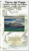
 Sample detail of the Tierra del Fuego Map
 Front of the Tierra del Fuego Map
 Reverse of the Tierra del Fuego Map
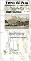
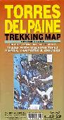
 Front of the Torres del Paine Map
 Reverse of the Torres del Paine Map
 Sketch map showing area covered by the Torres del Paine map
 Hiking/topographic maps by Pixmap/Aoneker GIS Solutions. With latitude/longitude and UTM grids (WGS84). These maps often use a satellite image as a basis for their maps, interpreting areas of snow, bare ground, vegetation and cultural features. Then they overlay contour lines, numerous spot elevations, roads, camping huts, etc. Typical size is 16½ x 23½".
 Sample of the map detail from the San Carlos de Bariloche map (64-1277-05)
 Image of the Copahue - Caviahue hiking map
 Sample detail from the San Pedro de Atacama hiking map


 Image of the whole map.


 Shows the summit of the mountain.