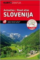
This atlas has 109 pages of maps, plus eleven city-center maps, traffic information and guidance, the legends and the table of distances between major towns in Slovenia. The maps show roads (road categorization, distances between road junctions, gas stations, etc.), tourism themes (hotels, inns, spas, mountain huts, nature attractions, churches, castles, museums, archeological sites etc.). Atlas size is approximately 8 x 12 inches (20 x 30 cm.) Bilingual English/Slovene. ISBN 9789619329320
Sample of the Slovenia road atlas detail
$49.99
65-97892
Atlas.
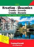
Croatia & Slovenia Supertouring Road Atlas. 1:150,000 (Croatia & Slovenia) & 1:3,500,000 (Europe). Freytag & Berndt. A very detailed road atlas with spot elevations marked, distances between villages shown, individual buildings shown in some cases, thousands of tourist sites and services noted, etc. Spiral-bound.
$29.99
65-6989
Atlas.
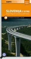
Slovenia Road Map. 1:300,000. Kartografija Slovenia, 2011. This 2011 map of Slovenia is at a scale of 1: 300 000 and shows the territory of the Republic of Slovenia, plus Istria and Kvarner. It is intended for planning a route around the country. The road network includes distances along main routes, the rail network, the state border, gentle relief with hypsometric shading, thematic elements and gas stations, hotels, motels, airports, ski slopes, caves, camping, interesting natural and cultural sites , national parks, thermal spas, marinas and tourist sites. On the back of the map is an index of place names. Size is 100 x 709 cm, multilingual including English.
Sample detail of the Triglav National Park Map
Slovenia Road Map. 1:150,000. Freytag & Berndt. This is a double-sided, detailed, indexed road map with hill-shading and spot heights showing the relief. The cartography is similar to 65-97901 listed above, but enlarged for greater clarity.
The road detail shows many minor roads, intermediate driving distances, toll routes, scenic routes, tourist routes, caravan traffic restrictions and long-distance hiking routes. Railways, ferries and airports are also shown. Symbols depict various landmarks and facilities such as churches, antiquities, locations of interest, ruins, castles, campsites, hostels, roadway service areas, border control points and technical assistance posts of automobile clubs.
Ten recommended places to visit are briefly described in the index booklet, which also contains street plans of Ljubljana and Maribor. Multilingual text and map legend, map size is 125 x 90 cm.
$14.99
65-97905
1 sheet, folded
Serbia, Slovenia, Croatia, Bosnia, Herzegovina, Macedonia, and Montenegro Travel Map. 1:600,000. Freytag & Berndt. This detailed road map covers all of the former Yugoslavia. Shaded relief shows elevation, roads are clearly marked, and tourist sites and services are marked. Multilingual legend, including English.
$14.99
65-5690F
1 sheet, folded
Ljubljana City Street Map. 1:15,000. Kartografija. Detailed city map by the new Slovenian mapping company Kartografija. Multilingual map legend.
Image of the entire Ljubljana city map
$15.99
65-9792LJ
1 sheet, folded.
Slovenia City Street Maps. Kartografija, Slovenia. Detailed city street maps.
Trekking in Slovenia - the Slovene High Level Route. Cicerone Guides.
To mountain walkers, Slovenia is best known for the Julian Alps, but it has a lot more than that to offer, and the Slovene High Level Route crosses some of the most varied and interesting landscapes to be found anywhere in Europe. From Maribor, close by the Austrian border in the north-east, to Ankaran on the Adriatic coast in the south-west, the route covers 500km of outstanding mountain and upland walking: the vast forested plateau of Pohorje; the sheer limestone peaks of the Julian and Kamnik-Savinja Alps with their via ferrata protected routes; the traditional alpine pastures and flower-strewn ridges of the Karavanke; and the forested hills and olive groves of the limestone karst country that stretch towards the coast.
Map showing the location of described treks
$29.95
65-97951SL
Guide
Mountain Biking in Slovenia. Cicerone Guides.
Guidebook to 35 mountain biking routes in Slovenia. Ranging from 12km to 59km, the routes are circular, negating any need for logistical 'return' planning. Graded from Blue to Black, the routes range from technically not difficult but requiring a reasonable level of fitness to highly technical, requiring a high level of fitness and confident bike handling skills.
Showcasing a remarkably diverse landscape, Slovenia is an idyllic (and incredibly, little known) mountain biking destination. From the towering peaks of Gorenjska and the stunning riverside trails of the Soca Valley to the tremendous limestone caves of the Karst region and the forests of the Nanos plateau in the country's south, there is endless opportunity for tough climbs, long descents and technical trails â as well as scenic trips lakeside and through vineyard-laced landscapes.
Full route descriptions are accompanied by 1:75,000 mapping and gradient profiles, together with practical information such as getting to and around Slovenia, travelling with the bike, arranging accommodation and dealing with emergency situations. A handy Slovenian language glossary is also included.
Map showing the location of described treks
$27.95
65-97951MB
Guide
Julian Alps of Slovenia. Cicerone Guides.
This book contains around over 60 walks which bring the best of the Julian Alps to the English-speaking walker. The walks are organized around five bases Kranjska Gora, Bovec, Kobarid, Bled and Bohinj all of which have a range of accommodation and public transport facilities. There is something here for everyone from easy valley walks and rougher forest trails to high-mountain protected routes, some of which require Alpine mountaineering experience. Several possibilities for multi-day walks are included.
The Julian Alps are situated at the south-eastern end of the Alpine chain. Their highest peak, Triglav, at 2864m, may be smaller than some of the better-known western giants, but what the mountains lack in stature they make up for in interest and accessibility. The dramatic limestone peaks drop steeply through forests to flower meadows, and will give you a feast for the eyes no matter which direction you turn.
Map showing the location of described treks Shows a summary map for one of the treks.
$27.95
65-97951JU
Guide
Walking in Slovenia - the Karavanke. Cicerone Guides.
This guidebook offers 23 walking routes across the 120km Karavanke mountain range, a natural border between Austria and Slovenia. The one and two-day routes are graded for difficulty, and range from low-level walks to high summits. The approaches are mainly from the Slovenian valleys, with bases in unspoilt towns and villages.
Map showing the location of described treks
$24.95
65-97951KA
Guide
Slovenia Hiking and Cycling Maps
Triglav National Park Hiking Map. 1:25,000. Kartografji d.o.o., Slovenia.
The central part of the Triglav National Park on a waterproof and tear-resistant, contoured and GPS compatible map. With details of local mountain shelters with photos and QR codes on the reverse side of the map. The map is centered on the peak of Triglav and coverage extends north to Kranjska Gora, south to the Bohinj Lake, west to Trenta, and east to Bohinjska Bistrica in the south-eastern corner of the map.
Sample of the Triglav National Park map detail
$19.99
65-9771-TR
1 sheet, folded.
Triglav National Park Hiking Map. 1:50,000. Kartografji d.o.o., Slovenia.
This map of Triglav National Park at 1:50,000 is a topographic map with hiking and cycling trails marked. The reverse side has descriptions of the area's best sights. Coverage extends from Bovec in the west to Bled in the east, and from Kranjska Gora in the north to just short of Tolmin in the south.
There are also are bilingual descriptions of the region's places of interest, including special notes on the World War I Isonzo Front, plus a list of mountain huts and campsites with contact details.
Sample of the Triglav National Park map detail
Julian Alps - West Part. 1:75,000. This map covers the western part of the Julian Alps in NW Slovenia. Map covers the area of the Upper Soča Valley, Triglav National Park, and Cerkljansko Škofjeloško Hills, Val Canale, director and Natisone Valley. (Bled, Bohinj, Kranjska Gora, Bovec, Kobarid, Triglav).
$19.99
65-9772-06
Ljubljana and Surroundings. 1:75,000. Map covers the area Polhograjsko Hills, Sava level Posavje Hills (part), Dolenjsko valley, Ljubljana Marshes, the Crimean mountains and Cerknica. (Rayon, Cerknica, Postojna, Logatec Vrhnika, Gorenje you, Ljubljana, Medvode, FC, lithium Ivan?na York).
$19.99
65-9772-08
Notranjske (Inner) Kras Brkini, Dolenjska, White Landscape. 1:75,000. Map covers the area Snežnik, Blok, Nanos and Hrušica, beer valley, Javorniki, Kočevski, Novo mesto landscape Kočevski Rog, Gorjancevin Žumberk. (Ilirska Bistrica, Pivka, Postojna, Cerknica, Rayon, Gottschee, New City, ?rnomelj, Metlika).
$19.99
65-9772-05
Posavje Hills (Posavsko Hribovje). 1:75,000. Map covers the area of Celje basin Sotelsko, Kozjansko Regional Park, and Posavje Zasavja. (Zagorje, Trbovlje Lasko, Celje and Rogaska Slatina, Podcetrtek, Brežice Sevnica, Trebnje).
$19.99
65-9772-07
Slovenian Coast (Primorske). 1:75,000. Map covers the area coast, Carso, Gorizia, Vipava, Trnovski forest hills Idrija and Trieste. (New York, Trieste, Koper, Izola, Piran, Sežana Diva&ccon;a Ajdovščina Idrija).
$19.99
65-9772-03
Styria (Stajerska). 1:50,000. Map covers the area of Maribor Pohorje, Kozjak Slovenian hills and the Drava level. (FC, Dravograd Šentilj, Maribor, the Slovenian hills Lenart, Ptuj, Slovenian Bistrica, Slovenjske Konjice).
$19.99
65-9772-09
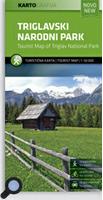
Triglav National Park (Triglavski Narodni Park). 1:50,000. Map covers the area of ??Triglav National Park in a more precise scale 1:50,000. This detailed topographic map offers better detail of tourist excursions, such as the remains of the Isonzo Front in the area.
Popular recreational areas of Slovenia on double-sided maps at 1:40,000 from Kartografija in Ljubljana, accompanied by bilingual guides with descriptions of hiking trails, cycling routes, places of interest, lists of mountain huts, etc.
The maps have contours at 20m intervals, enhanced by relief shading and graphics to provide a very effective picture of the topography. Waymarked hiking trails and cycling routes are prominently highlighted and cross-referenced to their descriptions in the accompanying guides. A wide range of symbols provide information on various types of accommodation (rural hotels, motels, farms, mountain huts, campsites), recreational facilities, picturesque locations, etc. For drivers, locations of petrol stations are marked. Each map is double-sided, with a good overlap between the sides, and has latitude and longitude lines at 2 intervals.
The accompanying pocket guides are bilingual, Slovenian/English, with around 60 to 80 pages. Approximately half are descriptions of places of interest, illustrated by colour photos. Descriptions of hiking routes give timings and the degree of difficulty, as do notes for cycling routes which are also accompanied by route profiles. Also provided is a list of mountain huts.
The Atlas of Slovenia for Schools and Homes (Atlas Slovenije za solo in dom). Mladinksa Kijiga & Geodetski zavod Slovenije. 1999. This atlas was published following Slovenian independence and was intended for use by the schools. The atlas contains a physical map at 1:300,000, city plans, and many thematic maps at 1:930,000. Hardbound, 96 pages.
$32.95
65-9747
Atlas
Slovenia Shaded Relief Map (Pregledna Solska Karta Slovenija). 1:500,000. Geodetski Zavod Slovenije. 1990. With tourist information on the reverse; in slovenian.

 Sample of the Slovenia road atlas detail

 Sample detail of the Triglav National Park Map
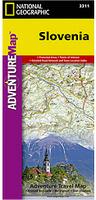 Waterproof!
 Sample detail of the Slovenia adventure map
 Image of the front of the Slovenia adventure map
 Image of the back of the Slovenia adventure map
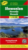

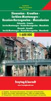

 Image of the entire Ljubljana city map
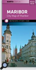
 Sample of the Ljubljana map.
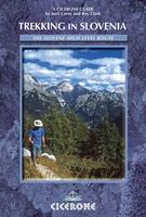
 Map showing the location of described treks
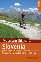
 Map showing the location of described treks
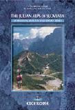
 Map showing the location of described treks
 Shows a summary map for one of the treks.
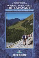
 Map showing the location of described treks
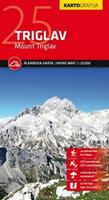
 Sample of the Triglav National Park map detail
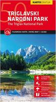
 Sample of the Triglav National Park map detail
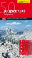
 Index to map coverage
 Sample detail of the Triglav National Park Map
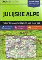
 Index to map coverage
 Sample detail of the Julian Alps Map