Waterproof Armenia Road Map. 1:250,000. Reise Know-How, 2015.
Road and rail networks are easy to see on a clear base which shows the country’s topography by altitude coloring with contours, spot heights, mountain passes, and names of mountain ranges. National parks and other protected areas are marked. Road network includes minor local roads, indicates border crossings, and shows intermediate driving distances on main and on selected secondary roads. Double-sided, printed on waterproof and tear-resistant synthetic paper.
Sample detail from the Armenia road map.
Armenia and Azerbaijan Travel Map. 1:560,000. ITMB.
One side concentrating on Armenia and its capital Yerevan, and the other side on Azerbaijan and its capital of Baku. It isn't a perfect separation, because each of these uneasy neighbours has long stretches of land protruding into the other country, and both have enclaves and hotly-disputed borders. The map shows roads by classification, airports, towns, villages, ruins, historical monuments, lakes, swamps, points of interest and other information. ISBN 9781553411178.
Armenia map sample
$12.95
65-6290
1 sheet, folded
Republic of Mountainous Karabakh - Political-Administrative Map. 1:300,000. Collage, Ltd., 2004.
The map shows four levels of road classification, six levels of urban classifications, and symbols for oil fields, gold fields, iron ore fields, copper mines, open and closed mines, six types of monuments and historical features. Bilingual, map size is 55 x 75 cm.
Sample of the map detail Thumbnail image of the entire map
$7.95
65-62700
1 sheet, folded.
Republic of Mountainous Karabakh - Physical Map. 1:300,000. Collage, Ltd., 2004.
The map uses hypsometric contour lines and spot heights (mountain tops) to show elevation. The map has four levels of road classification, railroads, airports, caves, volcanic centers, six levels of urban classifications, and symbols for oil fields, gold fields, iron ore fields, copper mines, open and closed mines, six types of monuments and historical features. Bilingual, map size is 20 x 27½".
$7.95
65-62701
1 sheet, folded.
Monuments of Armenian Highland Map. 1:1,150,000. Collage Ltd, 2005.
This map covers the region of Armenian culture, including eastern Turkey, Armenia, Karabakh, Nakhidjevan, northern Iran, southern Georgia, and western Azaerbaijan. The map has eighteen categories of monuments, including Armenian Christian monuments/churches/ruins; mosques; Byzantine and Arabian mausoleums; Assyrian, Byzanine, and Greek monuments, etc. Bilingual Armenian/English map size is 19 x 27".
Sample of the map detail Thumbnail image of the entire map
$7.95
65-6275
1 sheet, flat.
Armenia and Mountainous Karabakh Political-Administrative Map. 1:400,000. Collage, Ltd., 2005.
The map shows eight classification levels of cities and villages, three classification levels of roads with distances between route junctions, hydrography, state borders, RA marze and RMK region borders, and reservation borders. There is a data table that includes area and population of each marze and basic statistical data for Armenia and RMK. Bilingual Armenian/English, map size 70 x 100cm.
$12.95
65-62902
1 sheet, folded.
The Roads of Armenia Map. Collage, Ltd., 2005.
A small road atlas of Armenia and Mountainous Karabakh. Mileages between route junctions are shown on the map. There is a two-page map of Yerevan and its transit system. Includes a separate index booklet of place names and road and street signs. Bilingual Armenian/English.
$18.99
65-6289
Atlas.
Armenia & Yerevan Guide-Map . Collage, Ltd., 2005.
A simple double-sided tourist map, less detailed than the other maps listed here. The Armenia map is on one side and the Yerevan map on the reverse. The Yerevan map is indexed to show hotels, museums, embassies, theatres, special services such as fire, police, ambulance, tourist bureau offices, etc. Bilingual, map size 57 x 43 cm.
Sample of the Yerevan side of the map Thumbnail image of the Armenia side of the map
$12.95
65-62903
1 sheet, folded.
Birds of Armenia Reference Map. 1:500,000. American University of Armenia, 1999.
Although designed as a reference map for locations of bird species, the map is a good road map that shows numerous cities, towns, and abandoned villages as well as a latitude/longitude grid.
The reverse side has a detailed listing of bird species and latitude/longitude coordinates for confirmed sitings. In English.
$10.95
65-62901
1 sheet, folded
Armenia City Maps
Yerevan city map. No scale. Collage Ltd., 2003.
A street map of Yerevan with community borders, neighborhoods and streets named, oil and gas stations, bus stations, railroads, and more. Includes inset maps of Nubarashen and Yerevan subway system. The index includes geographic names, a list of street renamings, religious buildings, museums, health buildings, theaters, embassies, hotels, and banks. Bilingual Armenian/English, map size is 70 x 100 cm.
$14.99
65-6292Y
1 sheet, folded.
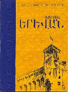
Yerevan city street atlas. 1:7,000. Collage Ltd., 2003.
Detailed street atlas of Yerevan. With block/address numbers, bilingual street and building names, and a full index. Plasticized soft-cover. ISBN 99930-981-1-6 (978-99930098119).
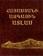
Armenia Atlas. Centre of Geodesy and Cartography" POAK, 2006.
Includes information on natural resources, culture, politics, population, economy, administrative units, and much more. Hardcover, 232 pages, 33 x 43 cm. In Eastern Armenian language.
Sample of one of the map pages.