Armenia and Azerbaijan Travel Map. 1:560,000. ITMB, 4th ed., 2010. One side concentrating on Armenia and its capital Yerevan, and the other side on Azerbaijan and its capital of Baku. It isn't a perfect separation, because each of these uneasy neighbours has long stretches of land protruding into the other country, and both have enclaves and hotly-disputed borders. The map shows roads by classification, airports, towns, villages, ruins, historical monuments, lakes, swamps, points of interest and other information. ISBN 9781553411178.
Armenia map sample
$12.95
65-6290
1 sheet, folded
Waterproof Azerbaijan Road Map. 1:400,000. Reise Know-How.
The map covers Azerbaijan and its Nakhchivan enclave; the armistice boundary of Nagorno-Karabakh is clearly marked, indicating open or closed border crossings, and where appropriate both Azeri and Armenian names of location are shown. Coverage includes eastern Armenia and south-eastern Georgia with Tbilisi. Double-sided, printed on waterproof and tear-resistant synthetic paper.
Sample detail from the Azerbaijan road map.
$14.99
65-63902
1 sheet, folded.
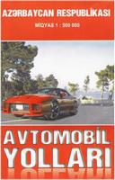
Azerbaijan Automobile Travel Map. BKF (Baki kartografiya Fabriki), 2009. Detailed road map of Azerbaijan. The map uses a shaded relief base map and overprints the road network. Includes a lot of detail for a map of this scale. In Azerbaijani language.
Sample detail of the Azerbaijan travel Map
$24.99
65-63901
1 sheet, folded.
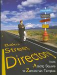
(Azerbaijan) Baku Street Directory - from Azadlig Square to Zoroastrian Temples. 1:4,000 to 1:22,500. Heron Print, Baku, 2006. An English-language atlas with very detailed mapping and extensive index of public facilities, banks, and a "yellow pages" section of restaurants, bars, and public companies/businesses.
$37.99
65-6392BA
Atlas
Baku City Map. 1:23,000 & 1:10,000. Baki Kartografiya Fabriki, 2006. A detailed map of Baku, in three languages including English. The reverse side has a 1:10,000 city-center map, plus descriptive text, photos, and other tourist information. Both maps use symbols to highlight tourist attractions and services.
$21.99
65-6392BE
1 sheet, folded.
Baku Topographic City Map. 1:10,000. 1993. A very detailed city street map with 5 meter contours, building footprints, and much more. 4 sheets, in color. In Azeri.
$89.95
65-6392BC
4 sheets, flat.
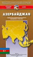
Azerbaijan Physical Map. 1:750,000. Roskartografia, 2005. A colorful shaded relief map of Azerbaijan, with 16 levels of color shading and spot heights to show elevation. The road and rail network is shown, with distances between road junctions marked. With a separate 30-page location index booklet. Both map and index are in Russian only.
$19.99
65-63471
1 sheet, folded.
Azerbaijan Physical Map. 1:500,000. Baki Kartografiya Fabriki (Azerbaycan Respublikasi Dovlet ve Xeriteçekma Komitesi). 1:500,000. 2006. A detailed physical/road map of Azerbaijan, in Azeri. The map uses hypsometric contour lines, color shading, spot heights, and shaded relief to show elevation. The map shows six levels of road classification, ports, and much more. 1 sheet, flat.
$19.95
65-6347
1 sheet, flat.
Absheron Peninsula Topographic Map (Baku Peninsula map). 1:100,000. Azerbaycan Respublikasi Dovlet Geodezia Komitesi, 1991. A very detailed topographic map of the Absheron Peninsula, on which Baku is located. The map has contour lines, and uses numerous symbols to identify/locate such features as airports, ports, 3 classifications of roads, factories, religious centers, swamps, passes, and much more. In Russian/cyrillic.
$14.95
65-6362
4 sheets, rolled.
Azerbaijan 1:100,000 Topographic Quadrangle Map Set. 1:100,000. Soviet government. High quality topographic maps for a country where almost nothing else is available. Digital versions only. In Russian.