Chile Hiking Maps. We stock hiking maps from several excellent publishers, including Trekking Chile, Zagier & Urutty, SIG Patagon, Pixmap, and JLM Mapas. Please check both the Chile Trekking Maps and the Patagonia Maps links below.
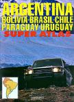
Southern South America Atlas (Atlas de Rutas). Firestone/Zagier & Urruty, 2015.
2015 edition of the most complete and updated atlas available for Argentina and surroundings (Chile, Bolivia, Uruguay, Paraguay and south of Brazil). Includes more than 168 city plans and 230 road maps, hotel and campsite lists, etc. Produced locally by Argentina experts and travelers. 220 pages, center-stapled soft-cover. ISBN 978-9872855932.
Sample detail from the city maps in the Atlas de Rutas. Sample detail from the road maps in the Atlas de Rutas.
$31.99
66-2488-2015
Atlas.
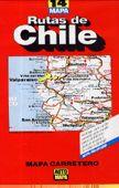
New map. Chile road map. 1:1,300,000. Editorial Compass, Chile.
This map covers all of Chile in five panels on a single double-sided waterproot and tear-resistant synthetic paper map. There are five levels of road classification shown on the map. Elevation is shown by color shading, with numerous names for physical features.
Place names are clearly displayed, making this an excellent map for planning trips.
This new-to-us 9-sheet regional road map set for Chile offers much better detail than any of the single-sheet road maps for the country. Each map is double-sided, with a small overlap from front to back and from the adjacent sheets north and south. The maps are printed on light-weight waterproof and tear-resistant synthetic paper.
These maps use satellite imagery as a base and add elevation coloring and shading to give a good representation of the elevation. The maps include numerous names of mountain ranges, mountain passes, peaks, and other physical features. National parks and other protected areas are highlighted.
The road classification used on these maps show paved roads, dirt roads, and hard and soft 4WD tracks. Border crossings, toll roads and booths, gas stations, police stations, etc. are also shown. Distances are shown on main roads and some secondary roads.
Argentina / Chile Travel Map. 1:2,000,000. Michelin #788.
Detailed road map of Argentina and Chile in the famous Michelin style. The map includes places of interest, a full index of place names, and a Buenos Aires city map.
Sample detail of the Argentina Travel Map
$12.95
64-12909
1 sheet, folded.
Chile Travel Map. 1:1,300,000. ITMB. Double sided road and travel map printed on synthetic paper, waterproof and durable in tropical conditions. Scale 1:3,000,000. Distinguishes roads ranging from divided highways to seasonal tracks. Legend includes railways, glaciers, international/national airports, landing strips, points of interest, police control, border crossings/customs posts, national parks, do not light fires, mines, light houses, shopping centres, museums, beaches, fortresses of interest, churches, springs, ski areas, campsites, archaeological sites, fishing, surfing, active volcanoes. Extensive index.
Sample detail from the Chile travel map.
$12.95
64-39902
1 sheet, folded
Laminated! Chile Travel Map. 1:1,600,000. Borch. Our soft-laminated folded map of Chile in the 4th edition shows: Northern Chile, Central Chile, Southern Chile & Patagonia 1:2 000 000, Torres del Paine National Park 1:240 000, Robinson Crusoe Island 1:200 000, Easter Island (Rapa Nui) 1:160 000, Punta Arenas, Antofagasta, Iquique 1:15 000, Valparaiso 1:10 000, Arica 1:16 000, La Serena 1:13 000, Vina del Mar 1:22 000, Santiago 1:20 000 and Chile administrative & time zones. Borch Maps are easy to fold, durable and water-repellent with a wipeable surface. Borch Maps show hotels, museums, monuments, markets, public transport, top sights and points of interest, useful statistics, conversion charts for temperatures, weights and measurements, climate charts showing temperatures, sunshine hours, precipitation and humidity, overview maps, time zones, and much more...
Sample detail from the Borch Chile travel map Image of the front of the Borch Chile travel map Image of the reverse of the Borch Chile travel map
$11.95
64-3991
1 sheet, folded
Waterproof! Chile Travel Map. 1:1,750,000. National Geographic Maps #3402, 2011. A double-sided detailed road map of Chile. Contour lines at 200 meter intervals and shaded relief show elevation. Tourist sites and services are noted by symbols. Fully indexed. Double-sided map, printed on waterproof, tear-resistant synthetic paper. The base map is by Reise Know-How, with NGS adding data and formatting the map in their classic adventure map format. ISBN 9781566955461.
Sample detail of the Chile Travel Map Image of the front of the Chile Travel Map
$11.95
64-39911
1 sheet, folded.
Chile Travel Map (Road map of Chile and Western Argentina). Various scales. Automapa (Chile). This map shows all of Chile in four regional strip maps. The main roads are shown, along with police and border checkpoints, customs posts, and national park boundaries. Elevation is generally lacking except for spot heights on the high peaks. In Spanish.
$15.99
64-39909
1 sheet, folded
Chile South & Patagonia Travel Map. 1:1,250,000 & 1:2,000,000. ITMB, December 2011. This map concentrates on the fast-changing southern portion of Chile (known as the Austral) and Patagonia, which technically only exists in southern Argentina, but in reality can't be shown easily on a map without including the same area in Chile. Thus, one side concentrates on Chile south of Los Angeles (yes, there's one there too!) in two long strip maps that go all the way to Cape Horn south of Tierra del Fuego. Although it has nothing to do with this part of Chile, ITMB have also included the main portion of touristic Easter Island, an inset of what is popularly referred to as Robinson Crusoe Island (Alexander Selkirk was marooned here for a number of years, and is the real-life model of the fictional Crusoe) and an inset map of Ushuaia. The other side shows all of Chile from Temuco south, and all of Argentina from Neuquen and Bahia Blanca south, with the Falklands correctly positioned in the South Atlantic.
Sample detail #1 of the Chile South and Patagonia Travel Map Sample detail #2 of the Chile South and Patagonia Travel Map
$12.95
64-39915
1 sheet, folded
Santiago street map. 1:8,000. Editorial Compass, Chile.
This map covers central Santiago facilities and places of interest, including the major tourist areas. The map does not cover all of Santiago's sprawling suburbs.
The reverse side has extensive tourist information, in both English and Spanish.
The map highlights the metro system and the jump-on / jump-off sightseeing buses. The main bicycle routes are also shown.
Santiago city map & Central Chile. 1:12,500 & 1:720,000. ITMB. This clear, indexed map shows the roads and places of interest in the city center. The coverage extends from the Estacion Central in the south-west to the Parque Metropolitano and Las Condes district in the north-east. The detail includes tourist sites such museums, scenic lookouts and shopping centres, as well as public facilities such as hospitals, police stations, post offices, pedestrian zones. The railway, subways and bus termini are indicated on the map, and inset maps show the Santiago Metro system diagram and the area around Santiago to Valparaiso. The reverse side includes a detailed travel map to Central Chile on the other side. The region covers from north of Valpariso and the major crossing route of the Andes all the way to Concepcion and Los Angeles at an enhanced scale. This map is perfect for day trips from Santiago, or better still, for a week-long exploration of the most developed part of Chile. Size is 98 x 68 cm.
Sample detail from the Santiago portion of the map Sample detail from the Central Chile portion of the map
$11.95
64-3992SC
Folded.
Easter Island & Santiago travel map. ITMB.
Shows general topography and tourist features. This map has a decent Santiago map on one side and the map of Easter Island on the opposite side.
Sample detail of the Easter Island map
$12.95
64-3975
1 sheet, folded
Tierra del Fuego Physical/Travel Map. 1:750,000. ITMB. A hypsometric map of Tierra del Fuego showing physical features, locations of tourist facilities and points of interest. Includes a small inset map of the center of Ushuaia. Bilingual.
$9.95
64-12740
1 set, folded
Chile Hiking Maps by Trekking Chile
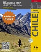
Central Chile Adventure Map. 1:500,000. Trekkingchile, Chile.
This map covers central Chile and the adjoining portion of Argentina. The map covers from the Pacific coast across the border to Mendoza, San Rafael and Malargue in Argentina, plus north of Santiago beyond the Aconcagua Massif and south to Chillan. National parks, reserves and other protected areas are highlighted. The road network indicates paved, gravel and unpaved roads and shows border crossings between the two countries and distances on main routes. Symbols indicate selected locations with tourist accommodation, recreational areas for climbing, beaches, thermal spas, etc. The map has a 20-km UTM grid. Map legend includes English.
The map uses satellite imagery as a base and overlays colorful relief shading and spot heights to show elevation.
Antuco - Laguna del Laja National Park – Volcán Antuco – Sierra Velluda trekking map. 1:30,000. Road network indicates paved or gravel roads and dirt tracks. The map shows trekking routes with distances and symbols highlight various places of tourist interest: campsites, cabins and other types of accommodation, restaurants, animal observation points, fishing tours and boat trips, etc.
$13.99
64-39765-CAB
Cabo Froward trekking map. 1:100,000. The map covers the south-eastern tip of the Brunswick Peninsula, from approx 45km south of Punta Arenas to Cape Froward. Contour interval is 50m, with colouring showing woodlands, shrubbery and pastures, swamps, sand, rocks, etc.
$13.99
64-39765-CAJ
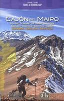
Cajón del Maipo trekking map. 1:100,000 / 1:50,000. covers the region eastwards along the River Maipo from Las Vertientes near its confluence with Rio Colorado to Volcán San José on the Argentinian border. The map shows the area’s network of roads and local tracks, indicating both unmarked and waymarked hiking trails. An extensive range of icons indicate various tourist facilities and places of interest including several types of accommodation, restaurants and cafes, banks, fuel supplies, recreational areas of climbing, canyoning, rafting, etc.
$13.99
64-39765-CON
Condor Circuit trekking map. 1:50,000 / 1:25,000. The main map at 1:50,000 covers the trekking area from Vilches Alto and Parque Inglés eastwards beyond Volcán Descabezado Grande. Contours are at 50m intervals. The map shows local roads, paths and trekking trails. Symbols highlight various accommodation facilities (hotels, campsites, refuges), eateries and grocery stores, sport and recreational sites, etc.
$13.99
64-39765-COS
Costa del Maule trekking map. 1:180,000 / various scales. The main map at 1:180,000 covers the coast of central Chile around the town of Constitución and the mouth of the River Maule. The map shows the area’s roads and local 4WD tracks and highlights hiking paths. Railway line along the Maule is shown with stops. Icons indicate various tourist facilities and places of interest including birdwatching sites, viewpoints, accommodation, horse riding stables, etc. Includes three larger scale maps for other beach and birding areas.
$13.99
64-39765-HUI
Huilo Huilo trekking map. 1:75,000 / 1:20,000. Huilo Huilo area around Neltume and Puerto Fuy near the Argentinian border at 1:75,000 with an enlargement at 1:20,000 and beautiful drawings of the local fauna and flora.
$13.99
64-39765-LAG
Laguna del Maule Winter Trails trekking map. 1:35,000. This ski and snowshoe map shows the area around the Laguna del Maule east of Talca.
$13.99
64-39765-LON
Longquimay trekking map. 1:100,000. The map covers the area around the peak of Lonquimay, between Curacautín in the west and beyond Lonquimay in the east. Contours are at 50m intervals. Road network includes 4WD tracks and local paths. Symbols highlight various types of local accommodation, including campsites.
$13.99
64-39765-MEL
Melado - Volcán San Pedro trekking map. 1:50,000 / 1:25,000. The main map at 1:50,000 covers the trekking area areas of the Melado River, including Volcán San Perdo, Volcán San Pablo and the nearby peaks. Includes detailed map of central Talca.
$13.99
64-39765-NEV
Nevados de Chillán trekking map. 1:50,000. The map is centred on El Trumao and extends north-east to include the main group of the volcanos: Nevado, Vidaurre, Chillán Nuevo and Chillán Viejo. Contours are at 50m intervals. Symbols show campsites, refuges, rangers’ huts, viewpoints, thermal springs, etc.
$13.99
64-39765-PUC
Pucón and Huerquehue National Park trekking map. 1:100,000 / 1:50,000. The map covers the area around Pucón, including Villarrica with Lago Villarrica and Volcán Villarrica, Huerquehue National Park, El Cañi Reserve, Lakes Caburgua, Colico and Calafquén, and Volcán Quetrupillan, with coverage along the Argentinian border extended on the reverse to include Volcán Lanín.
$13.99
64-39765-PUT
Putre - Lauca National Park trekking map. 1:100,000. Contours are at 50m intervals with numerous additional spot heights. Road network indicates 4WD tracks and local paths. Symbols highlight locations with tourist accommodations, camping sites, banks, mountain rescue posts, accessibility by local buses, etc.
$13.99
64-39765-PUY
Puyehue trekking map. 1:75,000. Contours are at 50m intervals with coloring and graphics showing different types of vegetation. The map shows local roads, paths and trekking trails, as well as shipping routes on the lakes.
$13.99
64-39765-SAN
San Pedro de Atacama trekking map. 1:350,000 / 1:50,000. The main map shows the San Pedro de Atacama area at 1:350,000. It has contours at 100m intervals plus graphics/colouring to show both soil cover and vegetation. Road network indicates 4WD tracks and local paths; railway lines are included and local airports are marked. Symbols show campsites, viewpoints, geysers, mines, etc.The reverse has a 1:50,000 scale map of San Pedro de Atacama.
Torres del Paine Hiking Maps
See Click here for additional maps of southern Patagonia & Tierra del Fuego by Zagier & Urutty.
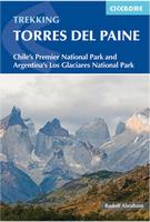
Torres del Paine Hiking Guide. Cicerone.
Guide book to treks in the Torres del Paine National Park, with emphasis on low-impact trekking. Routes include the Torres del Paine Circuit (10-11 days), Half Circuit (4-5 days) and other 2-day treks: Laguna Verde, Rio Pingo and Laguna Azul. Many other routes and information on mountain refuges and how to link routes together. Trekking in Torres del Paine - a national park since 1959 and a UNESCO Biosphere Reserve since 1978 - is a hugely rewarding experience. The Torres del Paine Circuit (a circuit of the park, and the main route described in this guide) is without any doubt one of the world's truly great treks, an opportunity to travel through awe-inspiring mountain scenery in an area with a fascinating history and rich in wildlife. Trails are for the most part clear and well marked within the national park, there is a comprehensive network of huts and campsites, and transport both to and within the park is all refreshingly simple.
$27.95
64-3995TO
Guide.
Waterproof! Torres del Paine Trekking Waterproof Map. 1:80,000. Zagier & Urruty.
Zagier & Urruty are beginning to offer their trekking maps in waterproof editions and this is the first map available. It is the same Torres del Paine map but printed on waterproof material.
Sample detail of the Torres del Paine map Sample detail of the Torres del Paine map
$16.99
64-3970W
1 sheet, folded
Hiking Maps for others areas in Chile
Nevado Ojos del Salado hiking map. 1:100,000. Alpenverein, Austria.
This mountain, located on the ridge crest of the Andes on the Argentina/Chile border is the 2nd highest mountain in South America, only about 200 ft. lower than Aconcagua. This is the best map for this popular climb. In German.
Index showing map coverage Sample of the map detail.
$19.99
64-39770
1 sheet, folded.
Cape Horn Historical Map (Cabo de Hornos, Isla de los Estados, Peninsula Mitre). 1:400,000. Zagier & Urruty.
Historical and hydrographical chart. Shipwrecks, lighthouses, gold diggers, missionaries, sealers, etc. Size is 102 x 72 cm.
$14.99
64-39714
Each, folded
Patagonian & Fuegian Channels & Chilean Fjords Cruise Chart. 1:200,000/1:250,000/1:1,400,000. Zagier & Urruty.
Historical and hydrographical chart. Cruise log for the intrincate coast of the south of South America. Insets of Beagle Channel "Glaciers Avenue" and Agostini Fjord. Size is 100 x 70 cm. ISBN 1-879568-96-9.
$14.99
64-39712
Each, folded
(Argentina/Chile) Santa Cruz & Tierra del Fuego. 1:1,125,000. Zagier & Urruty.
The southern tip of America from Coihaique and Copahue to Cape Horn. Estancias, National Road 40 and Carretera Austral. Patagonian Channels. National Parks and inns. Service charts and distances. Size is 74 x 110 cm.
$14.99
64-12704
Each, folded
Chile Hiking & Road Maps. JLM Mapas.
Sadly these maps are going out of print and we have limited stock left.
$16.99
64-3976-04
Aconcagua. 1:42,230. The reverse side has extensive descriptive text. Bilingual throughout.
$16.99
64-3976-06
Central Andes (Andes Centrales) - Cajon del Maipo. 1:250,000 & 1:70,000.
$16.99
64-3976-11
Bariloche - Cerro Catedral.
$16.99
64-3976-19
Tierra del Fuego - Cabo Froward.
$16.99
64-3976-23
Beagle Channel.
$16.99
64-3976-26
Estrecho de Magallanes, Isla Magdalena. 1:1,250,000.
$16.99
64-12912
Argentina road map.
Patagoniia (Chile and Argentina) Hiking & Road Maps. Pixmap. Pixmap, an Patagonian-based hiking map publisher, produces about 100 hiking maps. The maps, based on Chilean and Argentinian topographic maps, cover many popular climbing and hiking spots that are not covered by other publishers. Map scale of the maps ranges from 1:50,000 for volcanoes, icefields, and detailed hikes, to 1:500,000 for regional overview maps. A few of these are litho-printed maps, but most are color plots. The use of color plots means the publisher can offer a far larger range of titles. Most are in Spanish, some are bilingual.
Click here for hiking maps for Patagonia/Chile/Argentina by Pixmap. This is the full Pixmap listing of about 100 maps, with sample images, prices, etc.
Chile Topographic Maps
Chile 1:250,000 Topographic Quadrangle Maps. 1:250,000. Chile IGN. Please click here to see index maps, sample images, and complete listings.
Chile 1:50,000 Topographic Maps. 1:50,000. IGN, Santiago. We are now stocking the 1:50,000 topographic maps for the greater Santiago - Valparaiso region (see next item below). We can special order any other 1:50,000 topographic quads that are available. Delivery time is normally about 4-5 weeks. The sheets use the "South American 1956 Datum and Ellipsoid". In Spanish.
$34.95
64-3952-XXXX
Each, rolled, specify area of interest in the "Comments" section when you check out.
Chile 1:50,000 Topographic Maps for Santiago-Valparaiso. 1:50,000. IGN, Santiago. 1975-1987. We are now stocking the 1:50,000 topographic maps for the greater Santiago - Valparaiso region. There are eleven sheets needed for this coverage. The sheets use the UTM projection and the "South American 1956 Datum and Ellipsoid". In Spanish.
$297.00
64-3952-SAN
Set of 11 sheets, rolled
Chile Atlases
Atlas Histórico de Republica Chile. Instituto Geográfico Militar de Chile, May 2005. This small (7-1/4 x 10") pamphlet-style atlas offers an overview of the settlement and history of Chile. Includes maps showing migration routes, historical economy information, etc.
Softcover, 31 pages, in Spanish.
64-3966
Atlas.
Chile Geographic Atlas. 1988. Chile IGN. This atlas is a high school atlas. It covers numerous cultural, industrial, agricultural and mining topics in the first section. The second section covers Chile region by region. In Spanish.
$34.95
64-3949
Atlas
Chile Geologic and Thematic Maps
Chile Thematic Maps. 1:6,000,000. SNGM. Generalized maps. 30 x 91 cm. In Spanish.