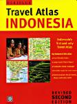
Indonesia Travel Atlas. Periplus. Softcover road and travel atlas. In English.
Contains 89 maps
Island and regional maps from 1:500,000 to 1:14,000,000
Area maps from 1:50,000 to 1:250,000
Detailed city and resort insets from 1:10,000 to 1:25,000
64-77906
Atlas
$18.95
Waterproof! Bali/Lombok/Komodo Road Map. 1:150,000. Reise Know-How. This map combines topographic mapping with road and tourist detail. The road information is clear and elevation is shown using contours, spot heights and altitude shading. The map shows six different types of roads, highlighting scenic routes, places of interest, archaeological sites, monasteries, monuments and viewpoints.
Digital versions available for immediate download! Digital versions are available for Compe-GPS, Fugawi, OziExplorer, PathAway, and Touratech-Quo Vadis, for use with a PocketPC or a PC.
64-7791-2
1 sheet, folded
$15.99
New title - Waterproof Borneo Travel Map (Kalimantan, Sarawak, Sabah). 1:1,200,000. Reise Know-How, 2011. This map covers the island of Borneo, which includes Indonesian Kalimantan and Malaysian Sarawak and Sabah, plus Brunei.
Sample detail of the Kalimantan map
64-77914-KAL
1 sheet, folded.
$15.99
Java Road Map. 1:650,000. Reise Know-How. This map combines topographic mapping with road and tourist detail. The road information is clear and elevation is shown using contours, spot heights and altitude shading. The map shows six different types of roads, highlighting scenic routes, places of interest, archaeological sites, monasteries, monuments and viewpoints.
Digital versions available for immediate download! Digital versions are available for Compe-GPS, Fugawi, OziExplorer, and Touratech-Quo Vadis, for use with a PocketPC or a PC.
64-77916
1 sheet, folded
$15.99
New title - Waterproof Lesser Sunda Islands Travel Map. 1:800,000. Reise Know-How, 2011. This map is a unified, single-scale map covering eastern Indonesia and Timor Leste - it is not individual island maps. The map includes Bali, Lombok, Sumbawa, Flores, Sumba, and on the reverse side eastern Flores, Timor, and Timor Leste. ISBN 9783831772391.
Sample detail of the Lesser Sunda Islands map
64-77914-SUN
1 sheet, folded.
$15.99
New title - Waterproof Sulawesi Travel Map. 1:800,000. Reise Know-How, 2010. This map is a unified, single-scale map covering Sulawesi. ISBN 9783831772391.
Sample detail of the Sulawesi map
64-77914-SUL
1 sheet, folded.
$15.99
Indonesia Travel Maps. Periplus. The Periplus maps are excellent tourist maps at a good price. There are city-center maps on one side and regional maps on the reverse. Descriptive text is included in the margins.
64-7789-11
Indonesia.
$8.95
64-7789-1
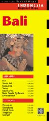
Bali, with south Bali. 1:250,000, with large-scale inset maps.
$8.95
64-7789-5
Bandung. 1:15,000.
$8.95
64-7789-7
Batam, Riau Province, & Bintan Islands.
$8.95
64-7789-2
Jakarta. 1:70,000 & inset maps.
$8.95
64-7789-4
Java (East) & Surabaya. 1:1,500,000 (East Java) and 1:25,000 (Surabaya).
$8.95
64-7789-10
Java & Bali. 1:600,000.
$8.95
64-7789-6
Lombok & Sumbawa. 1:200,000 with inset maps at larger scales.
$8.95
64-7789-8
Sulawesi.
$8.95
64-7789-9
Sumatra. 1:3,000,000 with numerous smaller map enlargements as inset maps.
$8.95
64-7789-12
Surabaya city map. 1:15,000.
$8.95
Indonesia Travel Map. 1:2,400,000. ITMB. Shaded relief physical/road map, with elevation shown by tinting and spot elevations.
64-77907
1 sheet, folded
$12.95
New edition! Bali and Lombok Travel Map. 1:145,000 and 1:130,000. ITMB, 2nd ed., Sept., 2009. Bali is a very special part of Indonesia; exceptionally popular with visitors from overseas. This new edition has detailed insets of Kuta(1:27,000), Sanur(1:16,000), Nusa Dua (1:40,000), and Lovina(1:30,000) areas highlighting beach resort facilities, and another inset showing the Ubud hill town resorts (1:35,000). As well, insets of Denpasar (1:22,000) and Singaraja (1:20,000) are included. On the other side is a new map of Lombok, the island just to the east of Bali, within Indonesia. Lombok is growing in tourist destination, especially in the three small islands known collectively as the Gili Islands (shown at 1:50,000). Also includes inset of Mataram(1:50,000). ISBN 9781553415466.
Bali map sample Bali map sample
64-7787-1
1 sheet, folded
$12.95
New! Java Travel Map. 1:300,000. ITMB, 1st ed., Sept., 2009. Java is centrally located in Indonesia, and the rich soil and hard-working people have turned the island into the economic powerhouse driving the country's economy. Indonesia's capital, Jakarta, is located on the island's north shore. This map concentrates on the island's many charms: the temples of Yogyakarta, the colonial architecture of Surabaya, and the rustic charm of mountainous East Java. The map abounds in insets, including central Jakarta at 1:25 000, but also Cirebon, Bandung, and Solo, Semarang, Surabaya, Yogyakarta, Malang, and Yoga to Prambanan at 1:90,000, and the Dieng Plateau at 1:35,000. The famous island of Krakatoa is also included. This map is double-sided (east/west). ISBN 9781553415466.
Java map sample
64-77917
1 sheet, folded
$12.95
Sumatra Travel Map. 1:1,100,000. ITMB, 1st ed., 2010. Due to its shape and setting, the map also includes Singapore and the southern portion of the Malay peninsula. The two main access points to Sumatra are by ferry from Singapore via
Batum Island, and from Java, or by air. This map also extends ITMB's Indonesian islands series, which includes Borneo, Bali/Lombok, Java, and New Guinea (in preparation). Touristically, Sumatra is not well-known, so is ideal for experienced
travelers to explore. The island offers several hot springs, royal palaces, colonial towns, and national parks. The map also includes generous inset maps of Medan, Padang, and Palembang. Double-sided, printed on paper. ISBN 9781553415442.
Sumatra map sample
64-77907-SU
1 sheet, folded
$12.95
New Guinea Travel Map. 1:2,000,000 (East part of island) and 1:1,650,000 (west part of island). ITMB, 1st ed. 2010. This totally new edition now includes the western part of the island - the Indonesian province of West Irian - thus offering complete coverage of New Guinea island, much like ITMB's other island maps for Borneo and Dominican Republic/Haiti. This map also includes some of the islands west of New Guinea, including the newly independent country of East Timor (not a lot of detail, but very handy to have it on this map). The legend includes: roads by classification, airfields, points of interests, wildlife reserves, lakes, museums, ferries, churches, beaches, waterfalls, ruins, volcanoes and more.
Sample detail from the New Guinea map.
65-15906
1 sheet, folded
$12.95
Indonesia Travel Maps. Nelles Verlag. These maps use shaded relief to show elevation. Extensive tourist information is included. While the scale of the P.T. Pembina maps is better, the Nelles maps show as much detail.
Indonesia and S.E. Asia Series
64-7790-9
Indonesia. 1:4,000,000.
$13.95
64-7790-3
Bali, Lombok. 1:180,000
$13.95
64-7790-5
Java, Jakarta. 1:750,000 and city street map of Jakarta.
$13.95
64-7790-4
Kalimantan, Brunei, East Malaysia 1:1,500,000.
$13.95
64-7790-7
Papua, Maluku. 1:1,500,000
$13.95
64-7790-6
Sulawesi. 1:1,500,000
$13.95
64-7790-1
Sumatra. 1:1,500,000.
$13.95
Street Atlases for Asian Cities, by Periplus. Periplus. Periplus, a major Asian publisher, produces several street and road atlases for parts of Indonesia, Singapore, etc. These are detailed atlases, in English, with street/town indexes.
64-7789-16
Bali. 172 pages, paperback.
$19.95
64-7789-17
Bandung. 1:12,000. 176 pages, paperback.
$19.95
64-7789-18
Surabaya.
$16.95
Puncak Trek Guidebook & Map Set (near Jakarta) - 4 maps and 4 guides. Alex Korns and WIPA (Wahana Informasi Pariwisata Alam), Indonesia, 2007. Within two hours of teeming, tropical Jakarta, by private or public transportation, lies a quiet, hilly, verdant countryside where resident Sundanese live much as they have for decades.
At the foot of Mt. Gede and Pangrango, residents practice traditional agriculture in the midst of great scenic beauty in harmony with the natural surroundings. Farmers walk the area and tend their fields using a complex network of public foot paths known only, until now, locally. At altitudes of 600-1800 meters, temperatures are several degrees cooler than in Jakarta.
Currently four of eight maps are available, covering the northern and eastern side of the mountains.
The set includes 4 detailed maps & 4 extensive guides totalling nearly 500 pages.
Each map:
Covers about 50 square km. at a scale of 6 centimeters to the kilometer (equivalent to 1:16,667).
Covers the edge of the forest, and therefore includes the lower section of the forest and the upper section of agricultural lands below the forest.
Shows hundreds of kilometers of footpaths and seldom used motor roads (stone or dirt roads) suitable for walking. Shows all the major crossings of each valley.
Shows a section of the 'Ring Route' around the twin peaks, roughly one-eighth of the entire route appearing in each map.
Provides UTM coordinates suitable for use with a GPS receiver, and shows a grid-square of boxes 250 meters wide.
Distinguishes 13 different kinds of land use areas.
Shows contour intervals of 12.5 m.
Shows hundreds of markers for scenic views, landmarks, facilities such as general shops and meatball soup shops, attractions such as waterfalls and places for viewing wildlife, etc.
Identifies 4 scenic 'circle routes' for which narrative text is provided in the guidebook, each 5-13 km. and requiring a half day or day to walk.
Printed on plastic Yupo paper for water repellency.
Each guidebook is designed around one of the maps, and thus covers an area of 50 square kilometers. Contents include:
The geography and history of the area, fauna and flora, what to see, how to get there and where to stay.
Photos from the area.
Narrative text for four circle routes in each sector, mentioning landmarks and objects of interest.
Limited stock Bogor City Map (Kodya Bogor). 1:12,500. C.V. Pradika. 1996. A reasonable city street map of Bogor, with many of the streets named. No index, however. More detailed than the map above, but covering a smaller area. In Indonesian.
64-7792BP
1 sheet, folded
$7.95
Limited stock Denpasar City Map (Kotamadya Denpasar). 1:18,000. PT Karya Pembina Swajaya. No date. A reasonable map showing the main streets of this city on Bali. Numerous symbols are used to show locations of tourist services and sites. Bilingual legend, but no street index.
64-7792DE
1 sheet, folded
$7.95
Jakarta city map. 1:20,000. Freytag & Berndt, 2008. Detailed city street map from this well-known European map publisher. Size is 120 x 94 cm.
64-7792JE
1 sheet, folded.
$12.95
Jakarta Street Map. 1:21,000 and 1:75,000. ITMB, 1st ed., 2010. Jakarta is a huge urban area, with a charming city centre. This double-sided map shows Greater Jakarta on one side, with its expressways and inter-urban train network and is, in my opinion very useful to business visitors to the city. It includes the airport, the city centre, the enormous soccer stadium (worth a visit), and the roads connecting the different neighbourhoods of this spread-out city. The other side concentrates on the central core of Jakarta, which is where most visitors would spend most time. Road and rail connections are clearly shown, as well as a good range of embassies, museums, hotels, gas stations, religious buildings, hospitals, and touristic attractions. ISBN 9781553416517.
Central Jakarta map sample Greater Jakarta map sample
64-7792JF
1 sheet, folded
$10.95
Limited stock; recommended Jakarta City Map. 1:20,000. CV. Indo Prima Sarana, 1997. A large-sized, full-color city street map similar in style and color to a Falk city plan. The map shows a fair amount of detail including minor streets, etc. Symbols show locations of tourist services and sites. Includes a 33-page street index with a listing of major hotels and museums. This map covers a larger area than the Nelles Verlag map. Bilingual.
64-7792JB
Set, folded
$12.95
Limited stock Malang City Map (Kotamadya Malang). 1:16,000. PT Karya Pembina Swajaya. No date. A more detailed map than the one listed above. Uses symbols to show locations of tourist services and sites. With bilingual legend, but no street index.
64-7792MC
1 sheet, folded
$7.95
Indonesia 1:250,000 Thematic Map Series
Indonesia Land Status, Recommended Development Areas. 1:250,000. 1988. Bakosurtanal. 143 of 201 sheets currently available - please see the index map link below for specific coverage. These maps delineate plantation borders, protected areas and forest categories. The maps come with an extensive legend describing soils, structure, lithology, temperature and rainfall. A seven-page legend is in Indonesian, while the maps are bilingual Indonesian-English. There is one bilingual sheet of the legend that defines the land use terms; for instance Pt=tea and Pk=rubber.
Indonesia 1:250,000 Land Status Index Map.
64-7730-XX
Each sheet, specify sheet number in the "Comments" section of the order form
$25.00
64-77301
Set of 143 sheets.
$2145.00
Indonesia--Present Land Use and Land Status. 1:250,000. 1989. Bakosurtanal. Currently there are 164 of 201 sheets available - please see the index map link below for specific coverage. These maps indicate the borders of nature preserves and plantations. They also show the present land use such as agriculture, forested areas and secondary forest growth. The maps come with an extensive legend describing soils, structure, lithology, temperature and rainfall. A seven-page legend is in Indonesian. However, there is one bilingual page that defines the land use terms; for instance Pt=tea and Pk=rubber.
Indonesia 1:250,000 Land Use Index Map.
64-7731-XX
Each sheet, specify sheet number in the "Comments" section of the order form
$25.00
64-77311
Set of 164 sheets.
$2460.00
.
Indonesia Atlases
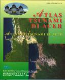
Recommended! Atlas of Tsunami in Aceh. BAKOSURTANAL, December, 2005. Bilingual atlas that covers the catastrophic tsunami that hit Aceh province in December 2004. The atlas uses satellite imagery, maps, photographs, tide and other scientific data to tell the story of the tsunami. The first sections are general information on Aceh, plate tectonics and the tsunami process. The rest of the atlas covers the damage to Aceh, the aftermath and recovery. Hardcover, 114 pages.
64-77620
Atlas.
$39.95
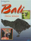
Bali from Space atlas (Indonesian Tourism Volume 1). Badan Koordinasi Survei dan Pemetaan Nasional, 2003. Superb aerial photographic/satellite imagery atlas of Bali. The atlas contains IKONOS, Landsat, and aerial photography coupled with descriptive text of the scenes shown. The first part of the atlas contains a series of small scale maps covering geology, administration, topography, etc. The bulk of the atlas contains aerial photographs and satellite imagery with descriptive text covering touristic sites, both cultural and natural. This imagery and text is organized by region. Bilingual English/Indonesian. Paperback, size is 6 x 8-1/2".
64-77630
1 sheet.
$19.95
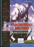
Tourism Atlas of East Java. BAKOSURTANAL, 2005.
64-77635
1 sheet.
$29.95
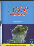
NTB from Space atlas - Nusa Tenggara Barat (Indonesian Tourism Volume 2). Badan Koordinasi Survei dan Pemetaan Nasional, 2004. Superb aerial photographic/satellite imagery atlas of Nusa Tenggara Barat. The atlas contains IKONOS, Landsat, and aerial photography coupled with descriptive text of the scenes shown. The first part of the atlas contains a series of small scale maps covering geology, administration, topography, etc. The bulk of the atlas contains aerial photographs and satellite imagery with descriptive text covering touristic sites, both cultural and natural. Bilingual English/Indonesian. Paperback, size is 6 x 8-1/2".
64-77640
1 sheet.
$19.95
Atlas of Resources Indonesia - Overview (Atlas Sumberdaya). BAKOSURTANAL, 2001. This atlas contains 100 pages of thematic maps, each with a page of descriptive text. Topics include export volume and trading partners, ratio between students and teacher, election data, marine transportation, rice production, etc. Bilingual. ISBN 9769-8647-58-0. 204 pages, paperback.
64-77477
Atlas
$29.95
Indonesia National Resource Atlas (Population Maps) (Atlas Sumber Daya Nasional). BAKOSURTANAL, 2000. This atlas contains maps covering population data for Indonesia on a province by province basis; primarily population distribution and population density. Bilingual. ISBN 9769-8647-45-9. 67 pages of maps, many with descriptive text on the reverse, paperback.
64-77489
Atlas
$49.95
Indonesia Administration Map (Atlas) (Indonesia Peta Administrasi). Variable scale. BAKOSURTANAL, 1999/2000. 32 pages of administration boundary maps on a province by province basis. ISBN 9769-8647-28-9. Bilngual, paperback.
64-77476
Atlas
$39.95
Sale price Digital Oceanographic Atlas of Indonesia - Part I, Indian Ocean. Direktorat Teknologi Inventarisasi Sumberdaya Alam Deputi Bidang Pengembangan Kekayaan Alam, BPP. 1996. This atlas gives the data from six cruises in waters off the coasts of Java, Sumatera, and Timor. Data include temperature, salinity and density of water; chemical composition and fish/plankton counts. The atlas includes horizontal profiles of temperatures, salinity, Dynamic Depth and Sigma-t at both the surface and 300 meter depth. Bilingual. Black and white. 49 pages, spiral-bound, soft-cover, 12 x 17 inches.
64-77486
Atlas
was $100.00
Sale price Digital Oceanographic Atlas of Indonesia - Part II, Eastern Indonesian Waters. Direktorat Teknologi Inventarisasi Sumberdaya Alam Deputi Bidang Pengembangan Kekayaan Alam, BPP. 1997. This atlas gives data from six cruises of the Makasar Straight, Northern Irian Jaya, Flores Sea, Vanda Sea, and the Sawu Sea. The same types of data were collected as in Volume 1. Bilingual, 49 pages, spiral-bound, soft-cover, 12 x 17 inches.
64-77487
Atlas
was $100.00
Sale price Marine Resources Atlas of Indonesia. 1997-1998. 1:5,000,000. Bakosurtanal. The atlas is divided into headings such as Jurisdictions, Marine, Protected Biodiversity and Social Economic. Within these categories the atlas provides text and maps concerning the following themes: Bathymetry, currents, sediments, coral reefs, wetlands, sealife habitat, fisheries, shipping lanes, ports and oil spill vulnerability. Bilingual, in color. 90 pages, softcover, 25 x 28 inches.
64-77485
Atlas
was $175.00
Sale price Land Resources Atlas (Atlas Sumber Daya Nasional). 1:1,000,000. Bakosurtanal. 1997-1998. This atlas is composed of two detailed multi-sheet thematic maps. Each map is 35 sheets with an extensive legend. The two themes are Land Use and Minerals. The base maps are geo-reference but do not have contour lines. In Indonesian. In color. 75 pages, softcover, 25 x 28 inches.
64-77483
Atlas
was $175.00
Indonesia National Resource Atlas - Soil Map. 1:1,000,000. BAKOSURTANAL, 1998/1999. Bililngual. Maps are 1:1,000,000 quadrangles, rather than provincial maps. Maps show cities/towns, main roads, and rivers, overlaid by the soil information. Oversize paperback. ISBN 979-8647-09-2.
64-7732
Atlas
$49.95
Indonesia--National Resources Atlas (Atlas Sumberdaya Nasional). Bakosurtanal. 1993. There are approximately 75 maps with accompanying text; some maps are double-page spreads, others are 4-to-a-page, depending on the island being covered and the topic. The shaded relief maps are fairly simplistic, but show the locations of all sorts of resources plus main roads and some distances124 pages, softcover, 12" x 15". In Indonesian.
64-77484
Atlas
$100.00
Atlas of Flora and Fauna of Indonesia (Atlas Flora dan Fauna Indonesia Untuk Pendidikan Dasar). BAKSURTANAL, 2000. This atlas contains a series of physical maps of the various regions and islands of Indonesia, each showing the location of various types of flora and fauna. Each map has pictures of the various species and there are several pages of descriptive text with each map. ISBN 979-8647-27-0. In Indonesian only. Paperback, 130 pages.
64-77479
Atlas
$49.95
Indonesia Transportation Atlas (Indonesia Atlas Transportasi). 1:1,000,000. BAKOSURTANAL, 2001. This atlas contains 92 pages of 1:1,000,000 scale road maps of Indonesia, done on a grid basis. The maps show lakes, rivers, villages, cities, airports, roads, etc. Bilingual. ISBN 979-8647-54-8. Paperback, 92 map pages.
Sample #1 Sample #2
64-77478
Atlas
$29.95
The Land Resources of Indonesia - A National Overview. 1:2,500,000. Bakosurtanal. 1990. This is an excellent summary of the land resources of Indonesia. This atlas contains 1:2,500,000 maps of the following themes: geology, mineral/energy resources, rainfall, agro-climatic zones, groundwater potential, physiographic types, potential development areas, soils, land cover, land use, environmental hazards, transmigration sites, population distribution and regional development. Bilingual. In color, 25 x 36 inches. Two volumes - volume 1 is an atlas of 14 fold-out maps, hardcover, 25 x 36 inches; volume 2 is a 282-page 8 x 11 inch hardover book. In English.
64-77482
Atlas
$100.00
Indonesia Political & Physical Maps
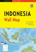
Indonesia wall map. 1:5,000,000. Periplus, 2006, 2nd edition. Folded, unfolds to 40 x 26.5 inches. Physical map, with numerous cities and towns. In English.
64-77461
1 sheet, folded.
$14.95
Wall maps of Bali, Bandung City, Bandung region, and Surabaya. Periplus.
64-7748-BB
Bali. 1:135,000. Rolled, 54" x 39".
$24.95
64-7748-BC
Bandung City. 1:12,000. Rolled, 54" x 39".
$24.95
64-7748-SU
Surabaya.
$19.95
Indonesia Political Map. P.T. Pembina. The larger map is mounted on linen with wooden hanging rods. The smaller map is a typical folded political map. The large map measures 230 x 110 cm while the small map measures 109 x 79 cm.
64-7747
Political map. 1:2,500,000.
$39.95
64-77471
Political map. 1:5,300,000.
$12.95
Indonesia--Physical Map. 1:4,500,000. P.T. Pembina. 1995. A shaded relief map with index along the bottom margin. 122 x 88 cm.
64-7748
Each
$9.95
Kalimantan Tengah Physical Map. 1:880,000. CV. Indo Prima Sarana. 1997. A hypsometric map of the Tengah portion of Kalimantan. The map also shows main hydrographic elements, cities and towns, airports, and more. Includes an inset map of the main streets of Palangkaraya. In Indonesian.
64-77491-KB
1 sheet, folded
$8.95
(Indonesia)--Purwakarta Administration Map (Peta Administrasi Kabupaten Dt. II Purwakarta). 1:75,000. PT. Fitratama Sempana. No date. A physical map of Purwakarta area of western Java. The map shows roads, administrative divisions, areas of vegetaion, etc. In Indonesian.
64-77491-PU
1 sheet, folded
$8.95
Indonesia Geologic and Thematic Maps
The Indonesia Geological Research and Development Centre has recently raised its prices on
geologic and thematic quadrangle maps to anywhere from $50 to $150 per sheet! We feel that these
prices are not reasonable, and we will no longer stock these maps. We will be selling off our
current inventory at the prices listed below.
Indonesia Geologic Map (Peta Geologi Indonesia). 1:2,000,000. 1965. USGS (I-414). Bilingual; 218 x 150 cm.