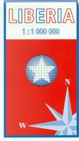
Liberia Travel Map. 1:1,000,000. IFB, 2009. This only travel map of Liberia that is currently available. The map shows vegetation, spot heights, roads, villages, airports, and more. Bilingual English/German.
Sample detail from the Liberia map.
64-94901
1 sheet, folded
$19.99
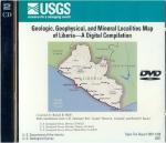
Geologic, Geophysical and Mineral Localities Map of Liberia: A Digital Compilation. USGS, 2007. A 2-DVD set including ArcGIS format geological, geophysical, and mineral location maps of Liberia. This is an update of the geo-thematic maps published in the early 1980's such as USGS I-1480.
System requirements: Microsoft Windows XP Professional Service Pack 2, 2 GHz Intel Pentium 4 CPU (or equivalent) required, 4 GBytes disk storage, application software must be able to read the imagery data in IBM PC order, ESRI ArcGIS desktop version 9.1, additional 3.3 GBytes disk storage for geodatabase and raster catalog data.
64-9401
DVD.
$109.99
Liberia Geologic Map. 1:1,000,000. 1983. USGS (I-1480). 107 x 69 cm.
64-9400
1 sheet, folded
$13.99
ONC 1:1,000,000 Topographic Maps. NGA. Military topographic survey mapping covering the world's land masses and significant islands. ONC stands for Operational Navigation Chart. These maps are designed primarily as flying charts for military aircraft, but they are useful as general topographical maps where nothing else is available. Two sheets offer complete coverage of Liberia.
67-1056-K01
Sheet K01 - northern Liberia
$34
67-1056-L01
Sheet L01 - southern Liberia
$34
 
Roberts Field City Topographic Map. 1:10,000. NGA/NIMA, 1993. No relief data on the map. The map uses a photomap as a base and overlays street and cultural information. In English.
64-9492RO
1 sheet, folded.
$34
 
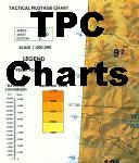
TPC 1:500,000 Topographic Maps. NGA. Military topographic survey mapping covering the world's land masses and significant islands. TPC stands for Tactical Pilotage Chart. These maps are designed primarily as flying charts for military aircraft, but they are useful as general topographical maps where nothing else is available. Two sheets offer complete coverage of Liberia.
67-1055-K01C
TPC Chart K01C
$34
67-1055-L01B
TPC Chart L01B
$34
 
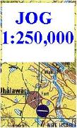
Liberia 1:250,000 Topographic Maps (JOG Charts). 1:250,000. NGA (NIMA). These charts are in English, are topographic maps with all of the normal topographic information; contours, power lines, roads, culture, etc.
Sample from the ND-29-13 sheet, Mali. Index showing available sheets. Click here for the complete listing of JOG charts.
67-10581-NB2901
JOG 1:250,000 topo NB-29-01. Bo, Sierra Leone.
$24.00
67-10581-NB2902
JOG 1:250,000 topo NB-29-02. Zorzor, Liberia.
$24.00
67-10581-NB2903
JOG 1:250,000 topo NB-29-03. Yekepa, Liberia.
$24.00
67-10581-NB2905
JOG 1:250,000 topo NB-29-05. Harbel & Monrovia, Liberia.
$24.00
67-10581-NB2907
JOG 1:250,000 topo NB-29-07. Zwedru, Liberia.
$24.00
67-10581-NB2910
JOG 1:250,000 topo NB-29-10. Buchanan, Liberia.
$24.00
67-10581-NB2911
JOG 1:250,000 topo NB-29-11. Juazohn, Liberia.
$24.00
67-10581-NB2915
JOG 1:250,000 topo NB-29-15. Harper, Liberia.
$24.00
67-10581-NC2913
JOG 1:250,000 topo NC-29-13. Sefadu, Sierra Leone.
$24.00
67-10581-NC2914
JOG 1:250,000 topo NC-29-14. Voinjama, Liberia.
$24.00
 
Liberia 1:200,000 Topographic Quadrangle Map Set. 1:200,000. Soviet government. High quality topographic maps for a country where almost nothing else is available. This set gives complete coverage of Liberia in 24 sheets. In Russian. Only available as digital maps.
64-9451R
Non-georeferenced maps, specify sheet number when checking out.
$20.00
64-9451RS
Non-georeferenced map set, 23 of 27 available..
$345.00
64-9451G
Geo-referenced maps, specify sheet number when checking out.
$25.00
Liberia Topographic Quadrangle Map. 1:50,000. 1982- continuing series. DOS (LIB 50). This series offers coverage of the northern border, northeast and southern regions. Approximately 62 of 160 sheets are available.