Waterproof! Mauritius Road Map. 1:90,000. Reise Know-How. This map combines topographic mapping with road and tourist detail. The road information is clear and elevation is shown using contours, spot heights and altitude shading. The map shows six different types of roads, highlighting scenic routes, places of interest, archaeological sites, monasteries, monuments and viewpoints.
66-1173
1 sheet
$15.99
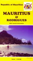
Mauritius & Rodrigues Travel Map. 1:90,000. ITMB, December 2011. The island, south and east of Cape Town, is a major sugar-producing country, with enormous tourist potential. Dozens of beach resorts already dot the coastline, including all the 'brand' names, which bodes well for the future. Naturally, we've shown all the roads, villages, touristic sites, and attractions, and have respected the heritage of the island by inter-mingling French and English names, just as exists on the islands.
Sample detail Mauritius Travel Map
66-11593
1 sheet, folded
$12.95
Reunion & Mauritius (Ile Maurice) Travel Map. 1:80,000. ITMB. 1st edition, May, 2013. The Indian Ocean island of La Reunion is a colonial remnant of the former French empire that still occupies bits and pieces of the Caribbean and the Indian Ocean. The main town and only airport is at St-Denis, on the north coast; however, the island's main harbour is simply called Le Port, on the west coast. Most of the beaches are along the south coast. The road network is well-developed, with a circular highway more-or-less following the coastline around the edge of the island and a cross-island route bisecting the eastern third, between the towns of Sainte-Pierre and Saint-Benoit. Tourism is now the island's major source of revenue after sugar exports, and hotels, resorts, and Oceanside resorts, hotels, and B&Bs abound.
Sample detail of the Reunion road map
66-11725
1 sheet, folded.
$12.95
Mauritius Tourist Map (Carte Touristique). 1:100,000. Institut Geographique National, France (515). This map offers basic tourist and topographic information. Bilingual.
66-1155
1 sheet
$16.95
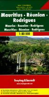
Mauritius Travel Map. 1:80,000. Freytag & Berndt. Standard road map with symbols showing tourist sites and services. Multilingual legend.
66-1159
1 sheet, folded
$15.99
Mauritius Topographic Map. 1:100,000. 1994. DOS (529). This map offers excellent topographic elevation detail, with both contour lines and spot heights. Liberal use of small symbols locate tourist sites and services, from lighthouses to monuments, from sugar factories to caves, from markets to post offices and much more. In English. 70 x 100 cm.
Sample of the Mauritius map detail