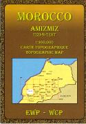
Waterproof! Morocco Adventure Map. 1:1,000,000. National Geographic Maps, 2011. National Geographic's Morocco AdventureMap is designed to meet the unique needs of adventure travelers-detailed, durable, and accurate. Morocco includes the locations of thousands of cities and towns with an index for easily locating them, plus a clearly marked road network complete with distances and designations for motorways, dual carriageways, major roadways, and more. ISBN 9781566955300.
Sample detail of the Morocco adventure map Image of the front of the Morocco adventure map Image of the back of the Morocco adventure map
$11.95
65-02909
1 sheet, folded
Waterproof! Morocco Travel Map. 1:1,200,000. ITMB, 2012, 3rd ed. One of the most stable and attractive Arabic countries for visitors is Morocco. The sea crossing from Spain is short, and travel facilities for visitors arriving by air are modern. This new edition has inset city-center maps of Casablanca, Marrakesh, Rabat/Sale, and Tangier. The people are hospitable, the accommodations satisfactory, the food excellent, and the scenery superlative. The map on durable plastic paper.
Sample detail from the Morocco Travel Map Sample detail from the Morocco Travel Map
$12.95
65-02901
1 sheet, folded.
Paper Morocco Road Maps
Recommended! Morocco Geographic Map & Wall Map. 1:1,250,000. GiziMap. An attractive, detailed physical map of Morocco. The map uses shaded relief and elevation shading to show relief. It includes roads, villages, spot heights, and much more. Available as either a folded map or wall map.
$14.99
65-02903
1 sheet, folded
$19.99
65-02904
1 sheet, flat/rolled.
Morocco Travel Map. 1:1,000,000. Michelin. Published by the world-famous Michelin company, this map combines detailed mapping with road detail and tourist information. The map uses shaded relief to show elevation and has a clear, easy-to-read road network.
Sample detail of the Morocco road map Thumbnail of the Michelin map
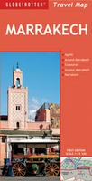
Marrakech City Map. 1:5,100. Globetrotter, Nov. 2009. City street map of main Marrakech at 1:5,100; two inset city-center maps of Agadir and Essaouira; and a large regional map of "Around Marrakech" at 1:500,000. Indexed, multilingual legend.
Sample detail of the Marrakech street map
$8.95
65-02892M
1 sheet, folded
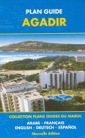
Morocco City Street Atlases (Plan Guide de ...). Bilingual French/English. These street atlases contain fold-out street atlas pages of the city, a street index, several additional indexes covering souks, monuments, etc. There is a removable folded street map in the back cover, identical to the atlas pages, except as a single-sheet folded map. The indexes and short descriptive text are bilingual English-French, or multilingual including English.
Sample of the fold-out atlas pages Sample of the full-sized map in the back pocket
$24.95
65-02891AG
Agadir Street Atlas. 1:10,000. 2003. 36 pages.
$24.95
65-02891CA
Casablanca Street Atlas. 1:15,000. 3rd ed., 2003. 130 pages.
$24.95
65-02891FE
Fes Street Atlas. 1:10,000. 2006. 99 pages.
$24.95
65-02891MA
Marrakesh Street Atlas. 1:6,500. 2nd ed. 2001. 39 pages.
$24.95
65-02891RA
Rabat/Salé Street Atlas. 1:12,500. 2nd ed., 2005. 109 pages.
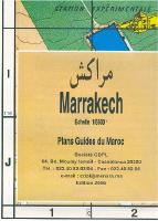
Morocco City Street Maps. These double-sided maps have a detailed street map on one side, and a regional map on the reverse. The street map is fully indexed and includes an index of tourist sites. In French with some English. These maps are the same maps included in the atlases above, except that they all cover a slightly smaller area than the atlas maps.
Sample of the map detail
$14.99
65-02892AG
Agadir Souss & Region city map. 1:10,000. 2007.
$14.99
65-02892CA
Casablanca city map. 1:11,500. 2004.
$14.99
65-02892MA
Marrakesh city map. 1:6,500. 2006.
$14.99
65-02892ME
Meknes city map. No scale. 2008.
$14.99
65-02892RA
Rabat city map. 1:12,500. 2006.
$14.99
65-02892TA
Tanger city map. 1:10,000. 2007.
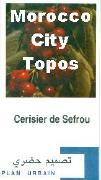
Morocco City Topographic Maps. 1:5,000 - 1:10,000. Morocco DCC. 2001-2007. These are very detailed topographic city street maps of 32 Moroccan cities. The maps have contour lines, spot heights, roads, railroads, buildings, and much more. Bilingual French-Arabic. These are color plots obtained directly from the the publisher, as regular printed maps were not done for this series. These are not tourist maps showing hotels, etc., rather these are governmental maps showing streets, etc. for planning purposes.
Sample of the Sefrou city map.
Morocco hiking maps. Morocco Direction du Cadastre et de la Cartographie. Detailed shaded relief maps of the most popular hiking spots in Morocco. In French.
$24.95
65-02755
Maroc Haut Atlas - Zaouiat Ahançal. 1:100,000. 1999. ;
$22.95
65-02756
Tadla - Azilal. 1:250,000. 2001. ;
Toubkal Trekking Map. 1:50,000. Orientazion. A single-sheet topographic and hiking map of the Toubkal region, printed on waterproof synthetic paper. The reverse side has a Marrakech city map. The map has 20 meter contours and spot heights to show elevation, a UTM grid and lat-long tick marks along the map margin, and symbols to denote religious buildings, springs, refuges (huts), and footpaths. Multilingual, including English.
$24.99
65-02752
1 sheet, folded.
Morocco Hiking/Trekking Guides
There are no Moroccan-issue topographic maps currently available for Morocco. There are Soviet military topographic maps available for Morocco - please see the links at the top of this page.
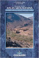
Trekking in The Atlas Mountains. By Karl Smith. Cicerone Press. The Atlas Mountains of Morocco offer an incredible variety of scenery, climate and terrain, where the Berbers' way of life has changed little in a thousand years. There are also opportunities to walk and climb throughout the year, making it a particularly desirable destination for the outdoor enthusiast. This new edition, now fully updated, provides you with all the information to help make your trip a successful one.The guide includes a useful introduction providing all the practical advice you will require as a visitor to Morocco. Detailed descriptions of walks to the three regions of Toubkal, Mgoun Massif and Jebel Sahro are given, and there is a separate chapter on other areas for walking in Morocco.A comprehensive appendix is also included, outlining useful addresses, bibliography and a glossary with information on the traverses and ski-touring possibilities in the area.
$19.95
65-02951AM
Guide
Morocco Physical and Political Maps
Morocco Hypsometric (General) Map (Carte Générale du Maroc). 1:2,500,000. 1979. Maroc MARA. This one-sheet map illustrates the main geographic features of the country. The major roads, cities, drainage patterns, and vegetation are shown. Color tinting indicates elevation. 72 x 74 cm.
$9.95
65-02505
1 sheet, rolled
Morocco Administrative Divisions Map (Carte Administrative). 1:2,500,000. 1989. Maroc MARA. Illustrates the major political boundaries of the country. In French.
$11.95
65-0281
1 sheet, rolled
Morocco Geologic and Thematic Maps
Morocco Population Density Map (Densité de Population). 1:2,000,000. Maroc MARA. 1982. In French/Arabic.