|
|
Seychelles Travel Maps. 1989. DOS. These two maps cover the largest of the Seychelles islands.
Seychelles Topographic Map. 1:200,000 & 1:2,000,000. 1983. DOS (604), Britain. This map offers basic coverage of the main island of Mahe and the Inner Islands at 1:200,000 and the entire group at 1:2,000,000 (for spatial reference). 71 x 90 cm.
Seychelles Topographic Quadrangle Map. 1:25,000. 1978-1979. DOS (304P), Britain. This series offers coverage of the larger islands.
Mahe 1:10,000 Topographic Quadrangle Maps. 1:10,000. DOS, Britain. This series offers coverage of Mahe island.
Praslin 1:10,000 Topographic Quadrangle Maps. 1:10,000. DOS, Britain.
Seychelles Outer Islands Topographic Maps. 1:10,000 & 1:12,500. DOS, Britain.
Seychelles Outer Islands 1:5,000 Topographic Maps. 1:2,500 to 1:5,000. DOS, Britain.
Mahe 1:2,500 Topographic Quadrangle Maps. 1:2,500. DOS, Britain.
Seychelles Geologic map. 1:50,000. 1963. Kenya G.S. Individual maps of the major islands. Complete with a 140-page text.
|
||||||||||||||||||||||||||||||||||||||||||||||||||||||||||||||||||
 Seychelles Maps
 Image of the front of the map
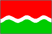
 Seychelles Flags