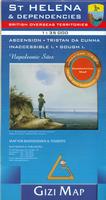
St. Helena Geographic Map. 1:35,000. Gizimap.
The island of St. Helena is shown at a scale of 1:35,000, ideal for hiking and driving. A small inset shows the street plan of central Jamestown 1:6,000. The other islands of the British Overseas Territories in the Atlantic (Tristan da Cunha, Ascension, Inaccessible Island and Gough Island) are shown at 1:75,000, with superb cartography and places of interest. The map excellently presents the topography of all the islands, with bright colouring and vivid relief shading, accompanied by spot heights and names of many peaks, valleys and other geographic features. Small settlements and many individual buildings are shown, roads and local tracks are marked. On St. Helena hiking trails are also highlighted and local administrative boundaries are marked. The map indicates locations with tourist accommodation and prominently shows various places of interest. Special highlighting marks sites associated with Napoleon's exile on St. Helena and the map also shows the boundary of the territory assigned to the deposed emperor. The remaining islands: Tristan da Cunha, Ascension Island, Gough Island and Inaccessible Island are all presented as separate insets at 1:75,000, with similar cartography and additional information. All the maps have latitude and longitude lines: St Helena at 1' intervals, the other islands at 2'. There is no index. Map legend in English, French, German, Italian and Spanish. With cardboard cover.
Sample detail from the St. Helena geographic map Image of the St. Helena geographic map
$14.99
66-10761
1 sheet, folded.
$19.99
66-10761R
1 sheet, flat/rolled.
St. Helena Topographic Map. 1:25,000. DOS (360). 1990.
Only available as a color plot. Size is 35 x 26 inches.
$19.99
66-1076
Color plot.
St. Helena Topographic Map. 1:50,000. OSD460. 1990. A simple black-white map of the island. Size is 12 x 14 inches.
$9.99
66-10758
1 sheet, folded.
St. Helena Topographic Map. 1:125,000. DOS 976. 1990. A simple page-sized color map of the island. Map size is 6.5 x 9.5 inches.
$7.99
66-10755
1 sheet.
St.Helena Topographic Quadrangle Maps. 1:10,000. DOS260/G893. 1990.
Six sheets give total coverage of the island.
$18.95
66-1077-1
Sheet 1 - northwest.
$18.95
66-1077-2
Sheet 2 - northcentral. Jamestown sheet.
$18.95
66-1077-3
Sheet 3 - northeast.
$18.95
66-1077-4
Sheet 4 - southwest.
$18.95
66-1077-5
Sheet 5 - southcentral.
$18.95
66-1077-6
Sheet 6 - southeast.
$95.52
66-1077S
Set of 6 sheets, rolled
St. Helena Land Use Map. 1:25,000. OSD (3273). 1990.
The land use map uses the topographic map as a base map and then uses a color overprint to show land use. Size is 35 x 26 inches.
$18.95
66-1075
1 sheet, rolled
St. Helena Agriculture and Forestry Map. 1:50,000. DOS 234. Red and black map showing forestry types and major agricultural crop distribution. Size is 12 x 14 inches.
$9.99
66-10751
1 sheet, rolled
St. Helena, Ascension, and Tristan de Cunha Travel Guide. Bradt Guides. This guide to St Helena, Ascencion & Tristan da Cunha is the only guide available dedicated to travel on these three islands. These islands, due to their remoteness, have numerous endemic plant species and huge seabird colonies which makes them very popular with birdwatchers and botanists worldwide. The guide has detailed practical listings and background information plus additional information of natural history, flora and fauna. Paperback.