|
|
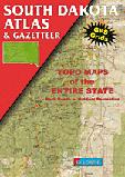
South Dakota Road Atlases
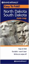
South Dakota Road MapsSouth Dakota Road Maps - Paper Maps
 Sample detail from the South Dakota road map. Sample detail from the South Dakota road map.
South Dakota Road Maps - Laminated Maps
South Dakota City Maps
South Dakota City, County, and State Business Wall Maps
We offer wall maps for Rapid City and Sioux Falls.
Click here to order city wall maps and to see sample images, prices, sizes, and mounting options.
We offer state and county wall maps for all of the USA. The maps come in sizes from 24 x 36 to 108 x 144 inches. They are available in variety of mounting and framing options. The maps are ideal for business applications, sales territory, delivery planning, direct mail targeting and hundreds of other applications. Click here to order county wall maps and to see sample images, prices, sizes, and mounting options. Click here to order state wall maps and to see sample images, prices, sizes, and mounting options.
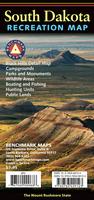
South Dakota Recreation Maps. click here. We stock a selection of fishing maps for South & North Dakota.
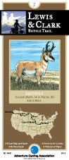
click here. We stock cycling maps for the "Lewis & Clark Cycling Trail" across South Dakota.
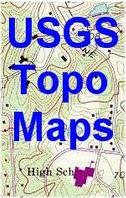
click here. We stock all USGS topographic maps of Connecticut at all available scales.
click here.
South Dakota Hiking Maps
Mt. Rushmore benchmark paperweight. Whether you're a climber, hiker, geography buff, or armchair traveler, you'll love to collect or give these unique bench mark paperweights that celebrate the spirit of exploration, athletic challenge, and personal achievement. Cast in pewter these summit marker paperweights are exact replicas of official USGS benchmark markers. Please click the "sample" button below to see an enlargement of the paperweight. Each marker has a soft felt pad on the bottom so these can be used on glass, wood, or any surface.
Harney Peak benchmark paperweight. The ancient and majestic peaks of the Black Hills were once more than 14,000 feet high. The natural forces of time have reduced them to half that leaving huge stone outcroppings everywhere to the delight of rock climbers, scramblers and hikers. The massive 50 foot stone fire lookout tower, constructed by the C.C.C. in 1938, is itself a survey monument. The location of the spire was used in the calculations of positions and elevations of points in the surrounding area
South Dakota Wall Maps.
We offer state and county wall maps for all of the USA. The maps come in sizes from 24 x 36 to 108 x 144 inches. They are available in variety of mounting and framing options. The maps are ideal for business applications, sales territory, delivery planning, direct mail targeting and hundreds of other applications. Click here to order county wall maps and to see sample images, descriptions, and prices. Click here to order state wall maps and to see sample images, descriptions, and prices.
Geological and Thematic MapsSouth Dakota Seismicity Map. 1:1,000,000. USGS (MF-1325), 1981. Black/white map showing epicenters, intensity, etc.
Geologic map of the Black Hills area, South Dakota and Wyoming. 1:250,000. USGS (#GI-1910D), 1989. 1 sheet, folded.
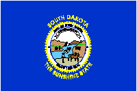
South Dakota Flags
|
||||||||||||||||||||||||||||||||||||||||||||||||||||||||||||||||||||||||||||||||||||||||||||||||||||||||||||||||
 South Dakota Maps
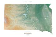
 A sample from the Maine atlas.
 Laminated!
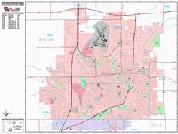
 Sample detail from the Sioux Falls wall map.
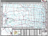 South Dakota County and State Wall Maps.
 Waterproof!
 Sample from the Badlands map
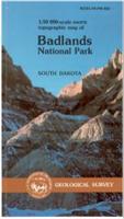
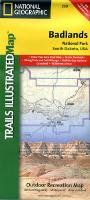
 Front of the USGS Badlands map
 Reverse of the USGS Badlands map
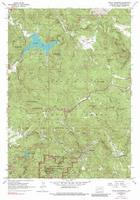
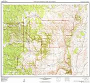
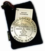
 Image of the Mt. Rushmore paperweight
 Image of the Mt. Rushmore lapel pin
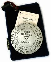
 Image of the Harney Peak paperweight
 Image of the Harney Peak lapel pin
 Thumbnail of the map.
 Sample of the detail.
 South Dakota Flags