Peak District & Derbeyshire Tour Map #04. 1:100,000.
$12.99
64-61853-05
Devon & Somerset Tour Map #05. 1:100,000.
$12.99
64-61853-08
Cotswolds & Gloucestershire Tour Map #08. 1:100,000.
$12.99
64-61853-10
North & Mid Wales Tour Map #10. 1:100,000.
$12.99
64-61853-11
South & Mid Wales Tour Map #11. 1:100,000.
$12.99
64-61853-12
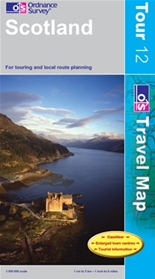
Scotland Tour Map #12. 1:500,000.
$12.99
 
Great Britain 1:250,000 Regional Road Maps. 1:250,000. AA (Automobile Association). This nine-sheet series covers all of Great Britain, produced by the AA (Automobile Association). The maps have particularly clear presentation of the road system, including speed cameras, and places of interest shown on a plain, unobtrusive base.
AA's regional road maps are characterised by their plain white base designed to provide an unobtrusive background for the road network and the names of towns and villages. Coloring is used only to show national parks and forests. Rivers and lakes are included, but other topographic information is limited to names of selected mountain ranges, peaks and valleys, plus spot heights. Steep roads have gradient signs.
Primary route destinations are highlighted and detailed information is provided on locations of speed cameras indicating speed limits. Services areas, tolls, etc., are marked and driving distance are given on A and selected B roads. Railway lines are shown with stations and ferry routes are included.
The plain base also provides a clear background for a very wide range of symbols highlighting and/or naming numerous places of interest, including National Trust or English Heritage sites and their equivalents in Scotland and Wales, sport and recreational facilities, etc, (although campsites are not included).
The index is on the reverse and each title also includes indexed street plans of city centres, indicating main traffic arteries, one way streets and parking facilities.
Sample of the map detail. Sketch map showing the area covered by each sheet
64-6191-1
West Country & South Wales. 1:200,000.
$12.99
64-6191-2
Central/Southern England. 1:200,000.
$12.99
64-6191-3
Southeast England. 1:200,000.
$12.99
64-6191-4
East Anglia. 1:200,000.
$12.99
64-6191-5
Midlands & Central England. 1:200,000.
$12.99
64-6191-6
Wales. 1:250,000.
$12.99
64-6191-7
Northern England. 1:200,000.
$12.99
64-6191-8
North of England & Scottish Borders. 1:200,000.
$12.99
64-6191-9
Scotland. 1:300,000.
$12.99
Harvey's Topographic Maps on Waterproof Paper
Harvey Maps has been making maps for over 25 years. Their maps are compiled from original aerial surveys and field checked by their team of surveyors and hikers.
Printed on waterproof, tear-resistant synthetic "paper".
Bright colors show land use features - forests, fields,
Rights of Way (England and Wales) and the Access Concordat (Scotland) are included.
Access area boundaries (National Trust etc.) are shown where appropriate. Naturally, the National Grid and Mountain Rescue posts are shown.
For safe navigation in all conditions, contouring shows land shape in detail. Marshy ground, peat hags and rocky ground are indicated, so walkers can avoid them if they choose.
United Kingdom Protected Environment Map. 1:1,000,000. OS. Shows the locations of all the environmentally protected areas of the U.K.
64-61651
1 sheet, rolled.
$9.95
United Kingdom Rainfall Map. 1:1,000,000. OS. Shows zones of rainfall overprinted on a hypsometric base map.
64-61653
1 sheet, rolled.
$9.95
United Kingdom Communication Map. 1:1,000,000. OS.
64-61650
1 sheet, rolled.
$19.95
.
Soviet Military Topographic Maps of Great Britain
Great Britain--1:50,000 Topographic Quadrangle Map Set for the United Kingdom. 1:50,000. Soviet government. High quality topographic maps for a country where all other maps are copyrighted. This set of 260 sheets gives coverage of the southeastern corner of Great Britain. In Russian.
64-61512
Set of 260 sheets, rolled
$2340.00
.
Isle of Man Topographic Maps
Isle of Man Topographic Map. 1:50,000. OS. This is the Landranger topo for the island.
64-6150-095
1 sheet, rolled
$15.99
Isle of Man Topographic/Rights of Way Map. 1:25,000. 1991. Isle of Man. An oversized two-sided map showing public trails, rights of way, etc. on a topographic base map. The best 1-sheet coverage available.
64-61742
1 sheet, folded
$13.95
Isle of Man Topographic Map. 1:25,000. OS. There are 12 sheets for full coverage. Black/white maps.
64-61745
Each, specify area
$18.95
64-61746
Set of 12 sheets, folded
$134.40
Isle of Man Topographic Map. 1:10,000. Isle of Man. There are 32 sheets in this set. This is the most detailed color coverage of the island. A special purchase allows a discounted price.
64-61747
Each, specify
$13.95
64-61747S
Set of 32 sheets
$358.40
Great Britain, Isle of Man--Douglas & Onchan Town Map. 1:7,500. IOM. Detailed street map with index.